
Electoral district of Hervey Bay
| Hervey Bay Queensland—Legislative Assembly | |||||||||||||||
|---|---|---|---|---|---|---|---|---|---|---|---|---|---|---|---|
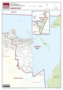 Map of the electoral district of Hervey Bay, 2017 | |||||||||||||||
| State | Queensland | ||||||||||||||
| Dates current | 1992–present | ||||||||||||||
| MP | Adrian Tantari | ||||||||||||||
| Party | Labor | ||||||||||||||
| Namesake | Hervey Bay | ||||||||||||||
| Electors | 39,626 (2020) | ||||||||||||||
| Area | 1,809 km2 (698.5 sq mi) | ||||||||||||||
| Demographic | Provincial (mainland) and remote (Fraser Island) | ||||||||||||||
| Coordinates | 25°15′S 153°3′E / 25.250°S 153.050°E | ||||||||||||||
| |||||||||||||||
Hervey Bay is an electoral district of Queensland. It was created in 1992.
Hervey Bay includes the city of Hervey Bay and the entire island of K'gari (Fraser Island).
Election results[change | change source]
| 2020 Queensland state election: Hervey Bay[1] | |||||
|---|---|---|---|---|---|
| Party | Candidate | Votes | % | ±% | |
| Labor | Adrian Tantari | 13,382 | 39.50 | +10.45 | |
| Liberal National | Steve Coleman | 11,637 | 34.35 | −3.37 | |
| One Nation | Damian Huxham | 3,773 | 11.14 | −14.09 | |
| Independent | Stuart Taylor | 3,001 | 8.86 | +8.86 | |
| Greens | Sonja Gerdsen | 1,061 | 3.13 | −1.94 | |
| Animal Justice | Amy Byrnes | 1,024 | 3.02 | +3.02 | |
| Total formal votes | 33,878 | 96.45 | +0.49 | ||
| Informal votes | 1,247 | 3.55 | −0.49 | ||
| Turnout | 35,125 | 88.64 | +0.15 | ||
| Two-party-preferred result | |||||
| Labor | Adrian Tantari | 17,625 | 52.02 | +11.12 | |
| Liberal National | Steve Coleman | 16,253 | 47.98 | −11.12 | |
| Labor gain from Liberal National | Swing | +11.12 | |||