
Guilford County, North Carolina
Guilford County is a county. It is in the United States state of North Carolina. In 2020, the Census Bureau estimated that 541,299 lived there.[1]
References[change | change source]
- ↑ "QuickFacts: Guilford County, North Carolina". United States Census Bureau. Retrieved August 16, 2023.
Municipalities and communities of Guilford County, North Carolina, United States | ||
|---|---|---|
| Cities | 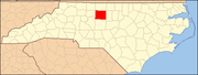 | |
| Towns | ||
| CDPs | ||
| Unincorporated communities | ||
| Footnotes | ‡This populated place also has portions in an adjacent county or counties | |

