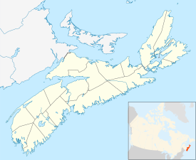
St. Peter's, Nova Scotia
St. Peter's
Gaelic: Baile Pheadair | |
|---|---|
 | |
| Nickname(s): Gateway to the Bras d'Or The Village on the Canal Where the Ocean meets the Inland Sea | |
| Coordinates: 45°39′52″N 60°52′33″W / 45.664555°N 60.875744°W | |
| Country | Canada |
| Province | Nova Scotia |
| Municipality | Richmond County |
| Founded | 1650 |
| Government | |
| • Village Chair | Esther McDonnell |
| • Village Committee | Commissioners of St. Peter's |
| Area | |
| • Total | 346.8 km2 (133.9 sq mi) |
| Highest elevation | 38 m (125 ft) |
| Lowest elevation | 0 m (0 ft) |
| Population (2001) | |
| • Total | 2,634 |
| • Density | 7.6/km2 (20/sq mi) |
| Time zone | UTC-4 (AST) |
| Postal code span | B0E 3B0 |
| Area code | 902 |
| Telephone Exchange | 535, 782 |
| Website | visitstpeters.com |
St. Peter's (Scottish Gaelic: Baile Pheadair; formerly known as "Santo Pedro", "Saint-Pierre", "Port Toulouse", and "St. Peters") is a small incorporated village located on Cape Breton Island in Richmond County, Nova Scotia, Canada.
Other websites[change | change source]
- Official Web Site
- St. Peters Canal National Historic Site Archived 2009-01-22 at the Wayback Machine
- St. Peters Lions Club Marina Archived 2020-01-20 at the Wayback Machine
- Wallace MacAskill Yacht Club


