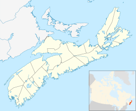
Canning, Nova Scotia
Canning | |
|---|---|
 | |
| Coordinates: 45°09′28.5″N 64°25′27″W / 45.157917°N 64.42417°W | |
| Country | |
| Province | |
| County | Kings |
| Established | 1760 |
| Government | |
| • Village Committee | Village of Canning Commission |
| • MLA | John Lohr (PC) |
| • MP | Scott Brison (L) |
| Population | |
| • Total | 2,589 |
| Time zone | UTC-4 (AST) |
| • Summer (DST) | UTC-3 (ADT) |
| Postal code | B0P 1H0 |
| Area code | 902 |
| Telephone Exchange | 582 |
| NTS Map | 021H01 |
| GNBC Code | CAGBD |
| Website | canning.ca |
Canning is a village in northeastern Kings County, Nova Scotia.
References[change | change source]
- ↑ "Browse Data by Community Profile, 2011 and 2006 censuses (Nova Scotia)". Government of Nova Scotia. December 18, 2012. Retrieved January 29, 2013.
Other websites[change | change source]
 Media related to Canning, Nova Scotia at Wikimedia Commons
- Canning Village (official website)
- Canning, Nova Scotia Archived 2010-05-23 at the Wayback Machine
- Fieldwood Heritage Society
- Harold Borden monument

