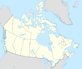
Northwest Territories
Northwest Territories
| |
|---|---|
|
| |
| Coordinates: 69°30′01″N 121°30′08″W / 69.50028°N 121.50222°W | |
| Country | Canada |
| Confederation | July 15, 1870 (Hudson's Bay Company cedes territory to Canada) (6th) |
| Capital | Yellowknife |
| Largest city | Yellowknife |
| Largest metro | Yellowknife |
| Government | |
| • Commissioner | Margaret Thom |
| • Premier | Caroline Cochrane (consensus government) |
| Legislature | Legislative Assembly of the Northwest Territories |
| Federal representation | Parliament of Canada |
| House seats | 1 of 338 (0.3%) |
| Senate seats | 1 of 105 (1%) |
| Area | |
| • Total | 1,346,106 km2 (519,734 sq mi) |
| • Land | 1,183,085 km2 (456,792 sq mi) |
| • Water | 163,021 km2 (62,943 sq mi) 12.1% |
| • Rank | Ranked 3rd |
| 13.5% of Canada | |
| Population (2016) | |
| • Total | 41,786 [1] |
| • Estimate (2020 Q3) | 45,074 [3] |
| • Rank | Ranked 11th |
| • Density | 0.04/km2 (0.1/sq mi) |
| Demonyms | Northwest Territorian[4] |
| Official languages | |
| GDP | |
| • Rank | 11th |
| • Total (2017) | C$4.856 billion[5] |
| • Per capita | C$108,065 (1st) |
| HDI | |
| • HDI (2018) | 0.908[6]—Very high (5th) |
| Time zone | UTC−07:00 |
| Postal abbr. | NT |
| Postal code prefix | |
| ISO 3166 code | CA-NT |
| Flower | Mountain avens |
| Tree | Tamarack Larch |
| Bird | Gyrfalcon |
| Rankings include all provinces and territories | |
The Northwest Territories is a territory in Northern Canada. 44,541 people live there as of 2018.[7] It is 1,171,918 square kilometers.
The capital of the Northwest Territories is Yellowknife. Yellowknife was the capital since 1967. The Northwest Territories have many geographical features, like the Great Bear Lake, the Mackenzie River and Nahanni River, which is a national park and a UNESCO World Heritage Site.
The Northwest Territories entered the Canadian Confederation in 1870. The Hudson's Bay Company gave the land to the Dominion of Canada. The Northwest Territories have one person in the House of Commons and the Canadian Senate. A lot of parts of the Northwest Territories were given to other provinces, including British Columbia, Alberta, Manitoba, Ontario, and Quebec. In 1999, the eastern part of the Northwest Territories became the territory of Nunavut.
References[change | change source]
- ↑ "Population and Dwelling Count Highlight Tables, 2016 Census – Canada, provinces and territories". 2016 Census. Statistics Canada. 8 February 2017.
- ↑ "Land and freshwater area, by province and territory". February 1, 2005.
- ↑ "Population by year of Canada of Canada and territories". Statistics Canada. September 26, 2014. Retrieved March 12, 2019.
- ↑ The terms Northwest Territorian(s) Hansard, Thursday, March 25, 2004 Archived March 24, 2009, at the Wayback Machine, and (informally) NWTer(s) Hansard, Monday, October 23, 2006 Archived March 24, 2009, at the Wayback Machine, occur in the official record of the territorial legislature. According to the Oxford Guide to Canadian English Usage (ISBN 0-19-541619-8; p. 335), there is no common term for a resident of Northwest Territories.
- ↑ "Gross domestic product, expenditure-based, by province and territory (2017)". Statistics Canada. September 17, 2019. Retrieved September 17, 2019.
- ↑ "Sub-national HDI - Subnational HDI - Global Data Lab". globaldatalab.org. Retrieved 2020-06-18.
- ↑ Government of Canada, Statistics Canada (8 February 2017). "Population and Dwelling Count Highlight Tables, 2016 Census". www12.statcan.gc.ca.
Other websites[change | change source]
| Definitions from Wiktionary | |
| Media from Commons | |
| News stories from Wikinews | |
| Quotations from Wikiquote | |
| Source texts from Wikisource | |
| Textbooks from Wikibooks | |
| Learning resources from Wikiversity | |


