Skokie, Illinois
Skokie, Illinois
Niles Center, Illinois | |
|---|---|
Village | |
 Downtown Skokie in 2013 | |
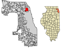
 Location of Skokie in Cook County, Illinois | |
 Location of Illinois in the United States | |
| Coordinates: 42°02′01″N 87°43′58″W / 42.03361°N 87.73278°W | |
| Country | |
| State | Illinois |
| County | Cook |
| Township | Niles |
| Incorporated | 1888 |
| Government | |
| • Type | Council–manager |
| Area | |
| • Total | 10.06 sq mi (26.07 km2) |
| • Land | 10.06 sq mi (26.07 km2) |
| • Water | 0.00 sq mi (0.00 km2) 0% |
| Population | |
| • Total | 67,824 |
| • Density | 6,739.27/sq mi (2,602.03/km2) |
| ZIP code(s) | 60076, 60077, 60203 |
| Area code(s) | 847 & 224 |
| Geocode | 70122 |
| FIPS code | 17-70122 |
| Website | skokie |
Skokie, Illinois is a village in Illinois. It was once known as Niles Center. It is on the northwest side of Chicago in Cook County. The area of Skokie is 10.1 square miles (2.62 square kilometers). According the 2020 census, its population was 67,824.[2]
History[change | change source]
Skokie was named Niles Centre in 1888. By 1910, the spelling of this name was changed to Niles Center. A nearby village was named Niles. This was confusing. The name of the village was changed to Skokie in 1940.
References[change | change source]
- ↑ "2020 U.S. Gazetteer Files". United States Census Bureau. Retrieved March 15, 2022.
- ↑ 2.0 2.1 "QuickFacts: Skokie village, Illinois". United States Census Bureau. Retrieved September 24, 2023.
Wikimedia Commons has media related to Skokie, Illinois.


