
Bibb County, Alabama
Bibb County | |
|---|---|
 Bibb County Courthouse and Confederate monument in Centreville | |
 Location within the U.S. state of Alabama | |
 Alabama's location within the U.S. | |
| Coordinates: 32°59′52″N 87°07′35″W / 32.99778°N 87.12639°W | |
| Country | |
| State | |
| Founded | February 7, 1818 |
| Named for | William W. Bibb |
| Seat | Centreville |
| Largest city | Brent |
| Area | |
| • Total | 626 sq mi (1,620 km2) |
| • Land | 623 sq mi (1,610 km2) |
| • Water | 3.6 sq mi (9 km2) 0.6% |
| Population | |
| • Total | 22,293 |
| • Density | 36/sq mi (14/km2) |
| Time zone | UTC−6 (Central) |
| • Summer (DST) | UTC−5 (CDT) |
| Website | www |
Bibb County is a county in the U.S. state of Alabama. Its name is in honor of William Wyatt Bibb, the first Governor of Alabama. As of 2020 the population was 22,293.[1] The county seat is Centreville.[2] It is a "prohibition" or dry county[3] which means alcoholic drinks cannot be sold.
History[change | change source]
Cahawba County was formed on February 7, 1818. It was named for the Cahawba River, (now more commonly "Cahaba River"). Cahawba is a Choctaw word for "water above." In 1820, it was renamed Bibb County.
Geography[change | change source]
According to the 2000 census, the county has a total area of 626.16 square miles (1,621.7 km2). 623.03 square miles (1,613.6 km2) (or 99.50%) is land and 3.14 square miles (8.1 km2) (or 0.50%) is water.[4]
Major highways[change | change source]
Rail[change | change source]
Adjacent counties[change | change source]
- Jefferson County, Alabama - north
- Shelby County, Alabama - northeast
- Chilton County, Alabama - southeast
- Perry County, Alabama - southwest
- Hale County, Alabama - southwest
- Tuscaloosa County, Alabama - northwest
National protected areas[change | change source]
Settlements[change | change source]
Cities[change | change source]
Towns[change | change source]
- Vance (part - Part lies in Tuscaloosa County)
- West Blocton
- Woodstock (Part lies in Tuscaloosa County)
Unincorporated communities[change | change source]
Places of interest[change | change source]
Bibb County is home to the Talladega National Forest. A section of the Cahaba River which draws visitors to view the unique Cahaba Lily, or Hymenocallis coronaria.
References[change | change source]
- ↑ 1.0 1.1 "QuickFacts: Bibb County, Alabama". United States Census Bureau. Retrieved August 8, 2023.
- ↑ "Find a County". National Association of Counties. Retrieved 2008-01-31.
- ↑ "Wet and Dry Counties of Alabama". Alcoholic Beverage Control Board. State of Alabama. Archived from the original on September 27, 2011. Retrieved July 27, 2011.
- ↑ "Census 2000 U.S. Gazetteer Files: Counties". United States Census. Retrieved 2011-02-13.
Municipalities and communities of Bibb County, Alabama, United States | ||
|---|---|---|
| Cities | 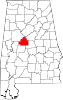 | |
| Towns | ||
| Unincorporated communities | ||
| Ghost town | ||
| Footnotes | ‡This populated place also has portions in an adjacent county or counties | |
| International | |
|---|---|
| National | |
| Other | |