
Chilton County, Alabama
Chilton County | |
|---|---|
 Chilton County Courthouse in Clanton | |
 Location within the U.S. state of Alabama | |
 Alabama's location within the U.S. | |
| Coordinates: 32°50′43″N 86°42′52″W / 32.8453°N 86.7144°W | |
| Country | |
| State | |
| Founded | December 30, 1868 |
| Named for | William Parish Chilton, Sr. |
| Seat | Clanton |
| Largest city | Clanton |
| Area | |
| • Total | 701 sq mi (1,820 km2) |
| • Land | 693 sq mi (1,790 km2) |
| • Water | 7.9 sq mi (20 km2) 1.1% |
| Population | |
| • Total | 45,014 |
| • Density | 64/sq mi (25/km2) |
| Time zone | UTC−6 (Central) |
| • Summer (DST) | UTC−5 (CDT) |
| Website | chiltoncounty |
Chilton County is a county of the U.S. state of Alabama. In 1942, the U.S. Navy commissioned a new vessel, the USS Chilton, in honor of Chilton County. In 2020, the population was 45,014.[1] The county seat is Clanton. It is a dry county which means alcoholic drinks cannot be sold.
The county is known for its peaches and its unique landscape. It is home to swamps, prairies and mountains due to the foothills of the Appalachians. It also has the Coosa River basin and is close to the Black Belt Prairie.
History[change | change source]
Baker County was formed on December 30, 1868. It was named for Alfred Baker, with its county seat at Grantville. Residents of the county asked the Alabama legislature for the renaming of their county. In 1874, they chose the name Chilton County. William Parish Chilton, Sr. (1810–1871), was a lawyer who became Chief Justice of the Alabama Supreme Court. Later he represented Montgomery County in the Congress of the Confederate States of America. It is not known when the county seat was moved.
Geography[change | change source]
According to the 2000 census, the county has a total area of 700.76 square miles (1,815.0 km2). 693.98 square miles (1,797.4 km2) (or 99.03%) is land and 6.78 square miles (17.6 km2) (or 0.97%) is water.[2]
Major highways[change | change source]
 Interstate 65
 U.S. Highway 31
 U.S. Highway 82
 State Route 22
 State Route 139
 State Route 145
 State Route 155
Adjacent counties[change | change source]
- Shelby County (north)
- Coosa County (east)
- Elmore County (southeast)
- Autauga County (south)
- Perry County (southwest)
- Dallas County (southwest)
- Bibb County (northwest)
National protected area[change | change source]
- Talladega National Forest (part)
Settlements[change | change source]
Cities[change | change source]
Towns[change | change source]
Unincorporated communities[change | change source]
References[change | change source]
- ↑ 1.0 1.1 "QuickFacts: Chilton County, Alabama". United States Census Bureau. Retrieved August 8, 2023.
- ↑ "Census 2000 U.S. Gazetteer Files: Counties". United States Census. Retrieved 2011-02-13.
Municipalities and communities of Chilton County, Alabama, United States | ||
|---|---|---|
| Cities | 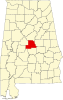 | |
| Towns | ||
| Unincorporated communities | ||
| Footnotes | ‡This populated place also has portions in an adjacent county or counties | |
| International | |
|---|---|
| National | |