
Coosa County, Alabama
Coosa County | |
|---|---|
 County courthouse in Rockford | |
 Location within the U.S. state of Alabama | |
 Alabama's location within the U.S. | |
| Coordinates: 32°56′11″N 86°14′47″W / 32.936388888889°N 86.246388888889°W | |
| Country | |
| State | |
| Founded | December 18, 1832 |
| Seat | Rockford |
| Largest city | Goodwater |
| Area | |
| • Total | 666 sq mi (1,720 km2) |
| • Land | 651 sq mi (1,690 km2) |
| • Water | 15 sq mi (40 km2) 2.3% |
| Population | |
| • Total | 10,387 |
| • Density | 16/sq mi (6.0/km2) |
| Time zone | UTC−6 (Central) |
| • Summer (DST) | UTC−5 (CDT) |
| Website | www |
Coosa County is a county of the U.S. state of Alabama. As of 2020, 10,387 people lived there.[1] Its county seat is Rockford.
History[change | change source]
It was formed on December 18, 1832. Its name is from a town of the Creek tribe.
Geography[change | change source]
According to the 2000 census, the county has a total area of 666.36 square miles (1,725.9 km2). 652.44 square miles (1,689.8 km2) (or 97.91%) is land and 13.91 square miles (36.0 km2) (or 2.09%) is water.[2]
Major Highways[change | change source]
Border Counties[change | change source]
- Talladega County (north)
- Clay County (northeast)
- Tallapoosa County (east)
- Elmore County (south)
- Chilton County (west)
- Shelby County (northwest)
Cities and towns[change | change source]
- Equality (part of Equality is in Elmore County)
- Goodwater
- Kellyton
- Rockford
References[change | change source]
- ↑ 1.0 1.1 "QuickFacts: Coosa County, Alabama". United States Census Bureau. Retrieved August 8, 2023.
- ↑ "Census 2000 U.S. Gazetteer Files: Counties". United States Census. Retrieved 2011-02-13.
Municipalities and communities of Coosa County, Alabama, United States | ||
|---|---|---|
| Towns | 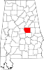 | |
| CDPs | ||
| Other unincorporated communities | ||
| Footnotes | ‡This populated place also has portions in an adjacent county or counties | |
| International | |
|---|---|
| National | |
| Other | |