Cleburne County, Alabama
Cleburne County | |
|---|---|
 Cleburne County Courthouse in Heflin in 2012 | |
 Flag | |
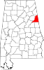
 Location within the U.S. state of Alabama | |
 Alabama's location within the U.S. | |
| Coordinates: 33°40′38″N 85°30′09″W / 33.6772°N 85.5025°W | |
| Country | |
| State | |
| Founded | December 6, 1866 |
| Named for | Patrick Cleburne |
| Seat | Heflin |
| Largest city | Heflin |
| Area | |
| • Total | 561 sq mi (1,450 km2) |
| • Land | 560 sq mi (1,500 km2) |
| • Water | 0.9 sq mi (2 km2) 0.2% |
| Population | |
| • Total | 15,056 |
| • Density | 27/sq mi (10/km2) |
| Time zone | UTC−6 (Central) |
| • Summer (DST) | UTC−5 (CDT) |
| Website | www |
Cleburne County is a county in the US state of Alabama. Its name is in honor of Major General Patrick R. Cleburne, of Arkansas. As of 2020, 15,056 people lived in the county.[1] Its county seat is Heflin.
History
[change | change source]Cleburne County was formed on December 6, 1866. The county was made from territory in Benton (now Calhoun), Randolph, and Talladega counties. In 1867, Edwardsville was made the county seat.[2] In 1905 Heflin became the county seat.[3]
Geography
[change | change source]
According to the United States Census Bureau, the county has a total area of 561 square miles (1,450 km2), of which 560 square miles (1,500 km2) is land and 0.9 square miles (2.3 km2) (0.2%) is water.[4] Alabama's highest natural point on Cheaha Mountain is in Cleburne County. Cheaha Mountain is in the far south part of the Blue Ridge Mountains.
Major highways
[change | change source]Rail
[change | change source]Border counties
[change | change source]- Cherokee County, Alabama – north
- Polk County, Georgia – northeast
- Haralson County, Georgia – east
- Carroll County, Georgia – southeast
- Randolph County, Alabama – south
- Clay County, Alabama – southwest
- Talladega County, Alabama – southwest
- Calhoun County, Alabama – west
National protected area
[change | change source]- Talladega National Forest (part)
Cities and towns
[change | change source]- Edwardsville
- Fruithurst
- Heflin
- Hollis Crossroads
- Micaville
- Muscadine
- Ranburne
References
[change | change source]- ↑ Jump up to: 1.0 1.1 "QuickFacts: Cleburne County, Alabama". United States Census Bureau. Retrieved August 8, 2023.
- ↑ "Cleburne County, Alabama history, ADAH". www.archives.state.al.us. Archived from the original on 2012-03-05. Retrieved 2012-03-29.
- ↑ "City of Heflin Website - City Information - Heflin, AL". www.cityofheflin.org.
- ↑ "2010 Census Gazetteer Files". United States Census Bureau. August 22, 2012. Retrieved August 22, 2015.
Municipalities and communities of Cleburne County, Alabama, United States |
|---|