
Tuscaloosa County, Alabama
Tuscaloosa County | |
|---|---|
 Location within the U.S. state of Alabama | |
 Alabama's location within the U.S. | |
| Coordinates: 33°12′23″N 87°32′05″W / 33.2065°N 87.5346°W | |
| Country | |
| State | |
| Founded | February 6, 1818[1] |
| Named for | Tuskaloosa |
| Seat | Tuscaloosa |
| Largest city | Tuscaloosa |
| Area | |
| • Total | 1,351 sq mi (3,500 km2) |
| • Land | 1,322 sq mi (3,420 km2) |
| • Water | 30 sq mi (80 km2) 2.2% |
| Population | |
| • Total | 227,036 |
| • Density | 170/sq mi (65/km2) |
| Time zone | UTC−6 (Central) |
| • Summer (DST) | UTC−5 (CDT) |
| Website | www |
Tuscaloosa County is a county of the U.S. state of Alabama.[1] It was named in honor of the Choctaw chief Tuskaloosa.[1] In 2020, 227,036 people lived there.[2]
References[change | change source]
- ↑ 1.0 1.1 1.2 "ACES Winston County Office" (links/history),Alabama Cooperative Extension System (ACES), 2007, webpage:ACES-Tuscaloosa.
- ↑ 2.0 2.1 "QuickFacts: Tuscaloosa County, Alabama". United States Census Bureau. Retrieved August 8, 2023.
Municipalities and communities of Tuscaloosa County, Alabama, United States | ||
|---|---|---|
| Cities | 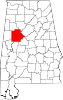 | |
| Towns | ||
| CDPs | ||
| Other unincorporated communities | ||
| Ghost town | ||
| Footnotes | ‡This populated place also has portions in an adjacent county or counties | |
| International | |
|---|---|
| National | |
| Geographic | |
| Other | |