
Autauga County, Alabama
Autauga County | |
|---|---|
 Autauga County Courthouse in Prattville | |
 Seal | |
 Location within the U.S. state of Alabama | |
 Alabama's location within the U.S. | |
| Coordinates: 32°32′12″N 86°38′54″W / 32.5367°N 86.6483°W | |
| Country | |
| State | |
| Founded | November 21, 1818 |
| Seat | Prattville |
| Largest city | Prattville |
| Area | |
| • Total | 604 sq mi (1,560 km2) |
| • Land | 594 sq mi (1,540 km2) |
| • Water | 10 sq mi (30 km2) 1.6% |
| Population | |
| • Total | 58,805 |
| • Density | 97/sq mi (38/km2) |
| Time zone | UTC−6 (Central) |
| • Summer (DST) | UTC−5 (CDT) |
| Website | www |
Autauga County is a county in the U.S. state of Alabama. As of the 2020 census the population was 58,805.[2] Its county seat is Prattville.[3]
Autauga County is part of the Montgomery Metropolitan Statistical Area.
Settlements[change | change source]
Cities[change | change source]
- Millbrook (part - some of Millbrook is in Elmore County)
- Prattville (part - some of Prattville is in Elmore County)
Towns[change | change source]
Unincorporated communities[change | change source]
Places of interest[change | change source]
Autauga County is home to several parks, such as Wilderness Park, Heritage Park, and Overlook Memorial Park.
Border counties[change | change source]
- Chilton County, Alabama - north
- Elmore County, Alabama - east
- Montgomery County, Alabama - southeast
- Lowndes County, Alabama - south
- Dallas County, Alabama - west
References[change | change source]
- ↑ "2019 Gazetteer Files for Counties: Alabama" (text). United States Census Bureau. Retrieved June 9, 2020.
- ↑ 2.0 2.1 "Autauga County, Alabama". United States Census Bureau. Retrieved August 7, 2023.
- ↑ "Find a County". National Association of Counties. Retrieved 2008-01-31.
32°32′12″N 86°38′54″W / 32.53667°N 86.64833°W
Municipalities and communities of Autauga County, Alabama, United States | ||
|---|---|---|
| Cities | 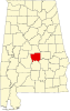 | |
| Towns | ||
| CDPs | ||
| Unincorporated communities | ||
| Ghost town | ||
| Footnotes | ‡This populated place also has portions in an adjacent county or counties | |
| International | |
|---|---|
| National | |
| Other | |