
Crenshaw County, Alabama
Crenshaw County | |
|---|---|
 Crenshaw County courthouse in Luverne | |
 Location within the U.S. state of Alabama | |
 Alabama's location within the U.S. | |
| Coordinates: 31°43′41″N 86°18′36″W / 31.728055555556°N 86.31°W | |
| Country | |
| State | |
| Founded | November 30, 1866 |
| Named for | Anderson Crenshaw |
| Seat | Luverne |
| Largest city | Luverne |
| Area | |
| • Total | 611 sq mi (1,580 km2) |
| • Land | 609 sq mi (1,580 km2) |
| • Water | 2.1 sq mi (5 km2) 0.3% |
| Population | |
| • Total | 13,194 |
| • Density | 22/sq mi (8.3/km2) |
| Time zone | UTC−6 (Central) |
| • Summer (DST) | UTC−5 (CDT) |
| Website | crenshawcountyalonline.com |
Crenshaw County is a county of the U.S. state of Alabama. As of 2020, 13,194 people lived there.[1] Its county seat is Luverne.
History[change | change source]
Crenshaw County was formed from Butler, Coffee, Covington, Lowndes and Pike counties on November 30, 1866. Its name is in honor of a judge, Anderson Crenshaw.
Geography[change | change source]
According to the 2000 census, the county has a total area of 610.88 square miles (1,582.2 km2). 609.58 square miles (1,578.8 km2) (or 99.79%) is land and 1.30 square miles (3.4 km2) (or 0.21%) is water.[2] Much of the land is covered by forests that are used for logging.
Major highways[change | change source]
Border counties[change | change source]
- Montgomery County (north)
- Pike County (east)
- Coffee County (southeast)
- Covington County (south)
- Butler County (west)
- Lowndes County (northwest)
Cities and towns[change | change source]
References[change | change source]
- ↑ 1.0 1.1 "QuickFacts: Crenshaw County, Alabama". United States Census Bureau. Retrieved August 8, 2023.
- ↑ "Census 2000 U.S. Gazetteer Files: Counties". United States Census. Retrieved 2011-02-13.
Municipalities and communities of Crenshaw County, Alabama, United States | ||
|---|---|---|
| Cities | 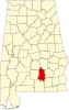 | |
| Towns | ||
| Unincorporated communities | ||
| Footnotes | ‡This populated place also has portions in an adjacent county or counties | |
| International | |
|---|---|
| National | |
| Geographic | |