
Hot Spring County, Arkansas
Hot Spring County | |
|---|---|
 Hot Spring County Courthouse in Malvern | |
 Location within the U.S. state of Arkansas | |
 Arkansas's location within the U.S. | |
| Coordinates: 34°19′07″N 92°57′14″W / 34.3186°N 92.9539°W | |
| Country | |
| State | |
| Founded | November 2, 1829 |
| Named for | hot springs at Hot Springs, Arkansas |
| Seat | Malvern |
| Largest city | Malvern |
| Area | |
| • Total | 622.16 sq mi (1,611.4 km2) |
| • Land | 614.94 sq mi (1,592.7 km2) |
| • Water | 7.22 sq mi (18.7 km2) 1.16% |
| Population | |
| • Total | 33,040 |
| • Density | 53/sq mi (21/km2) |
| Time zone | UTC−6 (Central) |
| • Summer (DST) | UTC−5 (CDT) |
| ZIP Codes | 71901, 71913, 71921, 71923, 71929, 71933, 71941, 71943, 71964, 72084, 72104, 72167 |
| Website | www |
Hot Spring County is a county of the U.S. state of Arkansas. As of the 2020 census, the population was 33,040.[2] The county seat is Malvern.[3] It was founded on November 2, 1829.
References[change | change source]
- ↑ Arkansas State Highway and Transportation Department in cooperation with the U.S. Department of Transportation (2014-10-16). Arkansas County Polygons (SHP file) (Map). Arkansas GIS Office. Retrieved January 1, 2017.
- ↑ 2.0 2.1 "QuickFacts: Hot Spring County, Arkansas". United States Census Bureau. Retrieved August 8, 2023.
- ↑ "Find a County". National Association of Counties. Archived from the original on 2011-05-31. Retrieved 2011-06-07.
Municipalities and communities of Hot Spring County, Arkansas, United States | ||
|---|---|---|
| Cities | 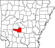 | |
| Towns | ||
| Townships | ||
| CDPs | ||
| Other unincorporated communities | ||
