List of counties in Minnesota
Appearance
There are 87 counties in the U.S. state of Minnesota.
Alphabetical listing
[change | change source]| County |
FIPS code | County seat[1] | Established[1] | Origin | Meaning of name[2][3][4] | Population (2020)[1][5] |
Area[1][5] | Map |
|---|---|---|---|---|---|---|---|---|
| Aitkin County | 001 | Aitkin | 1857 | Pine County, Ramsey County | William Alexander Aitken (1785-1851), early fur trader with Ojibwe Indians | 15,697 | 1,819.30 sq mi (4,712 km2) |

|
| Anoka County | 003 | Anoka | 1857 | Ramsey County | Dakota word meaning "both sides" | 363,887 | 423.61 sq mi (1,097 km2) |

|
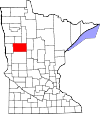
| Becker County | 005 | Detroit Lakes | 1858 | Cass County, Pembina County | George Loomis Becker, former state senator and third mayor of Saint Paul (1856–1857) | 35,183 | 1,310.42 sq mi (3,394 km2) |
|
| Beltrami County | 007 | Bemidji | 1866 | Unorganized Territory, Itasca County, Pembina County, Polk County | Giacomo Beltrami, Italian explorer who explored the northern reaches of Mississippi River in 1823. | 46,228 | 2,505.27 sq mi (6,489 km2) |

|
| Benton County | 009 | Foley | 1849 | One of nine original counties; formed from residual St. Croix County, Wisconsin Territory. | Thomas Hart Benton (1782–1858), former United States Senator from Missouri (1821-1851) | 41,379 | 408.28 sq mi (1,057 km2) |

|
| Big Stone County | 011 | Ortonville | 1862 | Pierce County | Big Stone Lake, a lake located in the county | 5,166 | 496.95 sq mi (1,287 km2) |

|
| Blue Earth County | 013 | Mankato | 1853 | Unorganized Territory, Dakota County | Blue Earth River, a river that flows through Minnesota | 69,112 | 752.36 sq mi (1,949 km2) |

|
| Brown County | 015 | New Ulm | 1855 | Blue Earth County | Joseph Renshaw Brown (1805-1870), member of Minnesota territorial legislature (1854-55) and prominent pioneer | 25,912 | 610.86 sq mi (1,582 km2) |

|
| Carlton County | 017 | Carlton | 1857 | Pine County, Saint Louis County |
Rueben B. Carlton (1812-1863), early settler and state senator (1857-1858) | 36,207 | 860.33 sq mi (2,228 km2) |

|
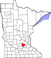
| Carver County | 019 | Chaska | 1855 | Hennepin County, Sibley County | Jonathan Carver (1710–1790), early explorer and cartographer of the Mississippi river. | 106,922 | 357.04 sq mi (925 km2) |
|
| Cass County | 021 | Walker | 1851 | Dakota County, Pembina County, Mankahto County, Wahnata County | Lewis Cass (1782–1866), senator from Michigan (1845–1857) and United States Secretary of State (1831–1836) | 30,066 | 2,017.60 sq mi (5,226 km2) |

|
| Chippewa County | 023 | Montevideo | 1870 | Pierce County, Davis County | Chippewa River, a river that flows through Minnesota | 12,598 | 582.80 sq mi (1,509 km2) |

|
| Chisago County | 025 | Center City | 1851 | Washington County, Ramsey County | Chisago Lake, a lake located in the county | 56,621 | 417.63 sq mi (1,082 km2) |

|
| Clay County | 027 | Moorhead | 1862 | Pembina County | Henry Clay (1777-1852), Kentucky statesman and ninth secretary of state of the United States (1825–1829) | 65,318 | 1,045.24 sq mi (2,707 km2) |

|
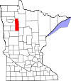
| Clearwater County | 029 | Bagley | 1902 | Beltrami County | Clearwater River and lake, both features located in the state | 8,524 | 994.71 sq mi (2,576 km2) |
|
| Cook County | 031 | Grand Marais | 1874 | Lake County | Named for Civil War veteran Major Michael Cook of Faribault, who was also a territorial and state senator 1857-62 | 5,600 | 1,450.60 sq mi (3,757 km2) |

|
| Cottonwood County | 033 | Windom | 1857 | Brown County | Cottonwood River | 11,517 | 639.99 sq mi (1,658 km2) |

|
| Crow Wing County | 035 | Brainerd | 1857 | Ramsey County | Crow Wing River | 66,123 | 996.57 sq mi (2,581 km2) |

|
| Dakota County | 037 | Hastings | 1849 | One of nine original counties. | From the Dakota language, after a local tribe Dakota, meaning "Allies" | 439,882 | 569.58 sq mi (1,475 km2) |

|
| Dodge County | 039 | Mantorville | 1855 | Rice County, Unorganized Territory | Henry Dodge (1782–1867), twice governor of Wisconsin.[6] | 20,867 | 439.50 sq mi (1,138 km2) |

|
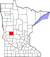
| Douglas County | 041 | Alexandria | 1858 | Cass County, Pembina County | Stephen Arnold Douglas (1813-1861), former United States Senator from Illinois (1847-1861) | 39,006 | 634.32 sq mi (1,643 km2) |
|
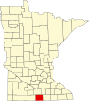
| Faribault County | 043 | Blue Earth | 1855 | Blue Earth County | Jean-Baptiste Faribault (1775-1860), early settler and fur trader | 13,921 | 713.63 sq mi (1,848 km2) |
|
| Fillmore County | 045 | Preston | 1853 | Wabasha County | Millard Fillmore (1800-1874), thirteenth president of the United States (1850-1853) | 21,228 | 861.25 sq mi (2,231 km2) |

|
| Freeborn County | 047 | Albert Lea | 1855 | Blue Earth County, Rice County | William S. Freeborn (1816-1900), member of the Territorial Legislature | 30,895 | 707.64 sq mi (1,833 km2) |

|
| Goodhue County | 049 | Red Wing | 1853 | Wabasha County, Dakota County | James Madison Goodhue, the first newspaper editor in Minnesota.[7] | 47,582 | 758.27 sq mi (1,964 km2) |

|
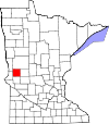
| Grant County | 051 | Elbow Lake | 1868 | Stevens County, Wilkin County, Traverse County | Ulysses S. Grant (1822-1885), eighteenth president of the United States (1869-1877) | 6,074 | 546.41 sq mi (1,415 km2) |
|
| Hennepin County | 053 | Minneapolis | 1852 | Dakota County | Father Louis Hennepin (1626-1705), early explorer of the Twin Cities area in the 17th Century | 1,281,565 | 556.62 sq mi (1,442 km2) |

|
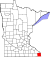
| Houston County | 055 | Caledonia | 1854 | Fillmore County | Sam Houston (1793–1863), the second and fourth president of the Republic of Texas and seventh governor of Texas | 18,843 | 558.41 sq mi (1,446 km2) |
|
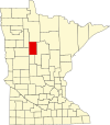
| Hubbard County | 057 | Park Rapids | 1883 | Cass County | Lucius Frederick Hubbard (1836-1913), ninth governor of Minnesota (1882-1887) | 21,344 | 922.46 sq mi (2,389 km2) |
|
| Isanti County | 059 | Cambridge | 1857 | Ramsey County | Division of the Dakotas called the Izatys, meaning [those that] dwell at Knife Lake, after where they resided. | 41,135 | 439.07 sq mi (1,137 km2) |

|
| Itasca County | 061 | Grand Rapids | 1849 | One of nine original counties; formed from residual La Pointe County, Wisconsin Territory. | Lake Itasca, source of the Mississippi River (located in northwestern Minnesota). | 45,014 | 2,665.06 sq mi (6,902 km2) |

|
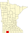
| Jackson County | 063 | Jackson | 1857 | Brown County | Henry Jackson, member of the first territorial legislature and the first merchant in St. Paul | 9,989 | 701.69 sq mi (1,817 km2) |
|
| Kanabec County | 065 | Mora | 1858 | Pine County | From the Ojibwe language Kan-a-bec-o-si-pi (Ginebigo-ziibi), meaning Snake River, which flows through the county | 16,032 | 524.93 sq mi (1,360 km2) |

|
| Kandiyohi County | 067 | Willmar | 1858 | Meeker County, Renville County, Pierce County, Davis County, Stearns County | From the Sioux language for "buffalo fish" | 43,732 | 796.06 sq mi (2,062 km2) |

|
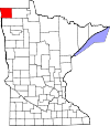
| Kittson County | 069 | Hallock | 1879 | Pembina County | Norman Kittson (1814-1888), businessman and mayor of Saint Paul (1858-1859) | 4,207 | 1,097.08 sq mi (2,841 km2) |
|
| Koochiching County | 071 | International Falls | 1906 | Itasca County | From the Ojibwe language Gojijiing (Place of inlets), which was the Cree name for Rainy Lake and Rainy River. | 12,062 | 3,102.36 sq mi (8,035 km2) |

|
| Lac qui Parle County | 073 | Madison | 1871 | Redwood County | French phrase meaning "lake which talks". | 6,719 | 764.87 sq mi (1,981 km2) |

|
| Lake County | 075 | Two Harbors | 1856 | Itasca County | Lake Superior, which forms one of its edges | 10,905 | 2,099.16 sq mi (5,437 km2) |

|
| Lake of the Woods County | 077 | Baudette | 1923 | Beltrami County | Lake of the Woods, a lake located within the county. | 3,763 | 1,296.70 sq mi (3,358 km2) |

|
| Le Sueur County | 079 | Le Center | 1853 | Dakota County | Pierre-Charles Le Sueur (1657-1704), fur trader and early explorer of the Minnesota River Valley | 28,674 | 448.50 sq mi (1,162 km2) |

|
| Lincoln County | 081 | Ivanhoe | 1873 | Lyon County | Abraham Lincoln (1809-1865), sixteenth president of the United States (1861-1865) | 5,640 | 537.03 sq mi (1,391 km2) |

|
| Lyon County | 083 | Marshall | 1871 | Redwood County | Nathaniel Lyon (1818–1861), United States Army general killed during the Civil War | 25,269 | 714.17 sq mi (1,850 km2) |

|
| McLeod County | 085 | Glencoe | 1856 | Carver County, Sibley County | Martin McLeod early pioneer and member of the territorial legislature (1849–1856) | 36,771 | 491.91 sq mi (1,274 km2) |

|
| Mahnomen County | 087 | Mahnomen | 1906 | Norman County | Ojibwa word meaning "wild rice". | 5,411 | 556.14 sq mi (1,440 km2) |

|
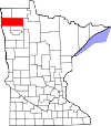
| Marshall County | 089 | Warren | 1879 | Kittson County | William Rainey Marshall (1825-1896), fifth governor of Minnesota (1866-1870) | 9,040 | 1,772.24 sq mi (4,590 km2) |
|
| Martin County | 091 | Fairmont | 1857 | Faribault County, Brown County | Morgan Lewis Martin (1805-1887), delegate to Congress from Wisconsin Territory | 20,025 | 709.34 sq mi (1,837 km2) |

|
| Meeker County | 093 | Litchfield | 1856 | Davis County | Bradley B. Meeker (1813–1873), Associate Justice of the Minnesota Territorial Supreme Court (1849–1853) | 23,400 | 608.54 sq mi (1,576 km2) |

|
| Mille Lacs County | 095 | Milaca | 1857 | Ramsey County | Mille Lacs Lake, a lake located within the county. | 26,459 | 574.47 sq mi (1,488 km2) |

|
| Morrison County | 097 | Little Falls | 1856 | Benton County | William & Allan Morrison, fur trading brothers[8] | 34,010 | 1,124.50 sq mi (2,912 km2) |

|
| Mower County | 099 | Austin | 1855 | Rice County | John Edward Mower (1815–1879), member of the Minnesota territorial legislature in the 1850s | 40,029 | 711.50 sq mi (1,843 km2) |

|
| Murray County | 101 | Slayton | 1857 | Brown County | William Pitt Murray (1825–1910), Minnesota statesman and member of the territorial legislature (1852–1855) and 1857 | 8,179 | 704.43 sq mi (1,824 km2) |

|
| Nicollet County | 103 | St. Peter | 1853 | Dakota County | Joseph Nicolas Nicollet (1786–1843), early explorer and cartographer of the Upper Mississippi River | 34,454 | 452.29 sq mi (1,171 km2) |

|
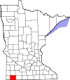
| Nobles County | 105 | Worthington | 1857 | Brown County | William H. Nobles, member of the Minnesota territorial legislature in 1854 and 1856 | 22,290 | 715.39 sq mi (1,853 km2) |
|
| Norman County | 107 | Ada | 1881 | Polk County | Early Norwegian, also known as Norman, settlers. | 6,441 | 876.27 sq mi (2,270 km2) |

|
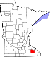
| Olmsted County | 109 | Rochester | 1855 | Fillmore County, Wabasha County, Rice County | David Olmsted, first mayor of Saint Paul and member of territorial legislature (1849-1850) | 162,847 | 653.01 sq mi (1,691 km2) |
|
| Otter Tail County | 111 | Fergus Falls | 1858 | Pembina County, Cass County | Otter Tail Lake, a lake located within the county | 60,081 | 1,979.71 sq mi (5,127 km2) |

|
| Pennington County | 113 | Thief River Falls | 1910 | Red Lake County | Edmund Pennington (b. 1848), executive of the Minneapolis, St. Paul and Sault Ste. Marie Railroad | 13,992 | 616.54 sq mi (1,597 km2) |

|
| Pine County | 115 | Pine City | 1856 | Chisago County, Ramsey County | Giant forests of Eastern White Pine and Red Pine that flourish in the county | 28,876 | 1,411.04 sq mi (3,655 km2) |

|
| Pipestone County | 117 | Pipestone | 1857 | Brown County | Name of a sacred Dakota quarry of red pipestone found in the county | 9,424 | 465.89 sq mi (1,207 km2) |

|
| Polk County | 119 | Crookston | 1858 | Pembina County | James K. Polk (1795-1849), eleventh president of the United States (1845-1849) | 31,192 | 1,970.37 sq mi (5,103 km2) |

|
| Pope County | 121 | Glenwood | 1862 | Pierce County, Cass County, Unorganized Territory | John Pope (1822–1892), United States Army general during the Dakota War of 1862 | 11,308 | 670.14 sq mi (1,736 km2) |

|
| Ramsey County | 123 | Saint Paul | 1849 | One of nine original counties; formed from residual St. Croix County, Wisconsin Territory. | Alexander Ramsey (1815-1903), second governor of Minnesota (1860-1863) | 552,352 | 155.78 sq mi (403 km2) |

|
| Red Lake County | 125 | Red Lake Falls | 1896 | Polk County | Red Lake River, a river that flows through Minnesota. | 3,935 | 432.43 sq mi (1,120 km2) |

|
| Redwood County | 127 | Redwood Falls | 1862 | Brown County | Redwood River, a river that flows through Minnesota. | 15,425 | 879.73 sq mi (2,278 km2) |

|
| Renville County | 129 | Olivia | 1855 | Nicollet County, Pierce County, Sibley County | Joseph Renville (1779-1846), interpreter for early explorations of the Louisiana Purchase | 14,723 | 982.92 sq mi (2,546 km2) |

|
| Rice County | 131 | Faribault | 1853 | Dakota County, Wabasha County | Henry Mower Rice (1816-1894), former United States Senator from Minnesota (1858-1863) | 67,097 | 497.57 sq mi (1,289 km2) |

|
| Rock County | 133 | Luverne | 1857 | Brown County | Large rocky plateau located within the county, known as "the mound." | 9,704 | 482.61 sq mi (1,250 km2) |

|
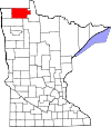
| Roseau County | 135 | Roseau | 1894 | Kittson County, Beltrami County | Roseau River and Roseau Lake, both of which are located nearby | 15,331 | 1,662.51 sq mi (4,306 km2) |
|
| Scott County | 139 | Shakopee | 1853 | Dakota County | Winfield Scott (1786–1866), United States Army general who served from (1808–1861) | 150,928 | 356.68 sq mi (924 km2) |

|
| Sherburne County | 141 | Elk River | 1856 | Benton County | Moses Sherburne (1813–1873), Associate Justice of the Minnesota Territorial Supreme Court (1853-1857) | 97,183 | 436.30 sq mi (1,130 km2) |

|
| Sibley County | 143 | Gaylord | 1853 | Dakota County | Henry Hastings Sibley (1811-1891), first governor of Minnesota (1858-1860) | 14,836 | 588.65 sq mi (1,525 km2) |

|
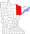
| St. Louis County | 137 | Duluth | 1855 | Itasca County, Newton | Saint Louis River, a river that flows through Minnesota | 200,231 | 6,225.16 sq mi (16,123 km2) |
|
| Stearns County | 145 | St. Cloud | 1855 | Cass County, Nicollet County, Pierce County, Sibley County | Charles Thomas Stearns (1814-1888), early settler of St. Cloud and member of the Minnesota territorial legislature (1849-1858) | 158,292 | 1,344.52 sq mi (3,482 km2) |

|
| Steele County | 147 | Owatonna | 1855 | Rice County, Blue Earth County, Le Sueur County | Franklin Steele (1813-1880), early settler of Minneapolis and developer of Saint Anthony Falls | 37,406 | 429.55 sq mi (1,113 km2) |

|
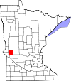
| Stevens County | 149 | Morris | 1862 | Pierce County, Unorganized Territory | Isaac Ingalls Stevens (1818-1862), first governor of Washington Territory (1853-1857) | 9,671 | 562.06 sq mi (1,456 km2) |
|
| Swift County | 151 | Benson | 1870 | Chippewa County | Henry Adoniram Swift (1823-1869), third governor of Minnesota (1863-1864) | 9,838 | 743.53 sq mi (1,926 km2) |

|
| Todd County | 153 | Long Prairie | 1855 | Cass County | John Blair Smith Todd, commander of Fort Ripley (1849-56); general in the Civil War; delegate in Congress from Dakota Territory (1861 and 1863-65); governor of Dakota Territory (1869-71) | 25,262 | 942.02 sq mi (2,440 km2) |

|
| Traverse County | 155 | Wheaton | 1862 | Pierce County, Unorganized Territory | Lake Traverse, a lake located in the county. | 3,360 | 574.09 sq mi (1,487 km2) |

|
| Wabasha County | 157 | Wabasha | 1849 | One of nine original counties. | Named after M'dewakanton Dakota Indian Chief Wabasha III | 21,387 | 525.01 sq mi (1,360 km2) |

|
| Wadena County | 159 | Wadena | 1858 | Cass County, Todd County | Wadena Trading Post, in turn for a Ojibway word meaning "a little round hill". | 14,065 | 535.02 sq mi (1,386 km2) |

|
| Waseca County | 161 | Waseca | 1857 | Steele County | Dakota word meaning "rich and fertile" | 18,968 | 423.25 sq mi (1,096 km2) |

|
| Washington County | 163 | Stillwater | 1849 | One of nine original counties; formed from residual St. Croix County, Wisconsin Territory. | George Washington (1732-1799), first president of the United States (1789-1797) | 267,568 | 391.70 sq mi (1,014 km2) |

|
| Watonwan County | 165 | St. James | 1860 | Brown County | Watonwan River, a river that flows through Minnesota. | 11,253 | 434.51 sq mi (1,125 km2) |

|
| Wilkin County | 167 | Breckenridge | 1858 | Cass County, Pembina County | Alexander Wilkin (1820-1864), Minnesota politician and soldier killed in the Civil War | 6,506 | 751.43 sq mi (1,946 km2) |

|
| Winona County | 169 | Winona | 1854 | Fillmore County, Wabasha County | Named after Wee-No-Nah, Sister or Cousin of Chief Wabasha III | 49,671 | 626.30 sq mi (1,622 km2) |

|
| Wright County | 171 | Buffalo | 1855 | Cass County, Sibley County | Silas Wright (1795-1847), former United States Senator from New York (1833-1844) | 141,337 | 660.75 sq mi (1,711 km2) |

|
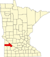
| Yellow Medicine County | 173 | Granite Falls | 1871 | Redwood County | Yellow Medicine River, a river that flows through Minnesota. | 9,528 | 757.96 sq mi (1,963 km2) |
|
References
[change | change source]- ↑ 1.0 1.1 1.2 1.3 National Association of Counties. "NACo County Explorer". Retrieved 10 January 2024.
- ↑ Upham, Warren (1969). Minnesota Geographic Names. St. Paul: Minnesota Historical Society.
- ↑ "County Name Origins". Association of Minnesota Counties. Archived from the original on 2008-05-27. Retrieved 2008-11-05.
- ↑ "Origin of Minnesota County Name". Minnesota Secretary of State. Archived from the original on 2008-11-08. Retrieved 2008-11-05.
- ↑ 5.0 5.1 "Minnesota QuickFacts". U.S. Census Bureau. Retrieved 6 April 2023.
- ↑ "Dodge County History" (PDF). Dodge County website. Archived from the original (PDF) on 2008-04-11. Retrieved 2008-02-17.
- ↑ "The History of Goodhue County". Goodhue County, Minnesota website. Archived from the original on 2008-06-06. Retrieved 2008-02-17.
- ↑ MCHS - William Morrison - Fur Trader Archived 2008-07-23 at the Wayback Machine

