
Haute-Vienne
Haute-Vienne | |
|---|---|
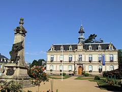
 Prefecture building of the Haute-Vienne department, in Limoges | |
 Flag  Coat of arms | |
 Location of Haute-Vienne in France | |
| Coordinates: 45°50′N 1°16′E / 45.833°N 1.267°E | |
| Country | France |
| Region | Nouvelle-Aquitaine |
| Département | 4 March 1790 |
| Prefecture | Limoges |
| Subprefectures | Bellac, Rochechouart |
| Government | |
| • President | Jean-Claude Leblois |
| Area | |
| • Total | 5,520.1 km2 (2,131.3 sq mi) |
| Population (2014)[3] | |
| • Total | 376,199 |
| • Density | 68/km2 (180/sq mi) |
| Demonym | Haut-Viennois |
| Time zone | UTC+1 (CET) |
| • Summer (DST) | UTC+2 (CEST) |
| ISO 3166 code | FR-87 |
| Arrondissements | 3 |
| Cantons | 21 |
| Communes | 200 |
| Website | www.haute-vienne.fr |
Haute-Vienne (Occitan: Nauta-Viena or Nauta-Vinhana) is a department of France in the region of Nouvelle-Aquitaine. It is named after the Vienne river that flows through the department.
History[change | change source]
Haute-Vienne is one of the 83 French departments made during the French revolution, on 4 March 1790. It was created from parts of the old province of Limousin, its southern half, and of the county of Marche, its northern half, as well as some parts of Angoumois and Poitou.
The new department had six districts: Limoges, Le Dorat, Bellac, Saint-Junien, Saint-Yrieix and Saint-Léonard. The capital (now prefecture) was Limoges.[4]
In 1800, with the creation of the arrondissements in France, the six districts were changed into four arrondissements: Limoges, Bellac, Rochechouart and Saint-Yrieix.[4]
On 10 September 1926, the arrondissement of Saint-Yrieix was eliminated.[4]
Geography[change | change source]
Haute-Vienne is part of the Nouvelle-Aquitaine region. It has an area of 5,520.1 km2 (2,131 sq mi).[2]
The department is bordered by 6 departments of 2 regions:
The department is in the nortwestern border of the Massif Central. Its altitude is 160–750 m (525–2,461 ft) high; the lowest point is in the valley of the Vienne river and the highest is in the mountains near the Vassivière lake. The highest point in the department is Puy de Crozat (45°47′30″N 1°50′45″E / 45.79167°N 1.84583°E), that is 777 m (2,549 ft) high.[5]
The main rivers in the department are the Vienne, that gives its name to this the deparment and to Vienne, and the Gartempe, a tributary of the Creuse river.
Climate[change | change source]
The climate of Limoges is an oceanic climate with template summers, Cfb (Marine West Coast Climate) in the Köppen climate classification.[6]
The average amount of precipitation for the year in Limoges is 726.4 mm (28.6 in). The month with the most precipitation on average is October with 86.4 mm (3.4 in) of precipitation. The month with the least precipitation on average is February with an average of 45.7 mm (1.8 in).
The average temperature for the year in Limoges is 11.4 °C (52.5 °F). The warmest month, on average, is July with an average temperature of 19.3 °C (66.7 °F). The coolest month on average is January, with an average temperature of 4.2 °C (39.6 °F).
Administration[change | change source]
The department is managed by the Departamental Council of the Haute-Vienne in Limoges. Haute-Vienne is part of the region of Nouvelle-Aquitaine.
Administrative divisions[change | change source]
There are 3 arrondissements (districts), 21 cantons and 200 communes (municipalities) in Haute-Vienne.[7]
| INSEE code |
Arrondissement | Capital | Population[8] (2014) |
Area[9] (km²) |
Density (Inh./km²) |
Communes |
|---|---|---|---|---|---|---|
| 871 | Bellac | Bellac | 39,744 | 1,779.9 | 22.3 | 62 |
| 872 | Limoges | Limoges | 298,578 | 2,944.8 | 101.4 | 108 |
| 873 | Rochechouart | Rochechouart | 37,877 | 795.4 | 47.6 | 30 |
The following is a list of the 21 cantons of the Haute-Vienne department, in France, following the French canton reorganisation which came into effect in March 2015:[10]
- Aixe-sur-Vienne (8701)
- Ambazac (8702)
- Bellac (8703)
- Châteauponsac (8704)
- Condat-sur-Vienne (8705)
- Couzeix (8706)
- Eymoutiers (8707)
- Limoges-1 (8708)
- Limoges-2 (8709)
- Limoges-3 (8710)
- Limoges-4 (8711)
- Limoges-5 (8712)
- Limoges-6 (8713)
- Limoges-7 (8714)
- Limoges-8 (8715)
- Limoges-9 (8716)
- Panazol (8717)
- Rochechouart (8718)
- Saint-Junien (8719)
- Saint-Léonard-de-Noblat (8720)
- Saint-Yrieix-la-Perche (8721)
Demographics[change | change source]
The inhabitants of Haute-Vienne are known, in French, as Haut-Viennois (women: Haut-Viennoises).[11]
Haute-Vienne has a population, in 2013, of 376,199,[3] for a population density of 68.2 inhabitants/km2. The arrondissement of Limoges, with 298,578 inhabitants, is by far the largest. The other two, Bellac and Rochechouart, have respectively 39,744 and 37,877 inhabitants.[8]
Evolution of the population in Haute-Vienne

The 10 most important cities in the department are:
| City | Population (2014)[8] |
Arrondissement |
|---|---|---|
| Limoges | 134,577 | Limoges |
| Saint-Junien | 11,196 | Rochechouart |
| Panazol | 10,734 | Limoges |
| Couzeix | 8,955 | Limoges |
| Isle | 7,520 | Limoges |
| Saint-Yrieix-la-Perche | 6,848 | Limoges |
| Feytiat | 6,147 | Limoges |
| Le Palais-sur-Vienne | 6,069 | Limoges |
| Aixe-sur-Vienne | 5,771 | Limoges |
| Ambazac | 5,628 | Limoges |
Gallery[change | change source]
-
 Abbaye de la Règle, Limoges
 -
-

-


Related pages[change | change source]
References[change | change source]
- ↑ "Le Président" (in French). Conseil Départemental de la Haute-Vienne. Retrieved 23 March 2017.
- ↑ 2.0 2.1 "Département de la Haute-Vienne (87)". Comparateur de territoire (in French). Institut national de la statistique et des études économiques - INSEE. Retrieved 27 March 2017.
- ↑ 3.0 3.1 "Populations légales 2014 des départements et des collectivités d'outre-mer" (in French). Institut national de la statistique et des études économiques - INSEE. Retrieved 27 March 2017.
- ↑ 4.0 4.1 4.2 "Historique de la Haute-Vienne". Le SPLAF (in French). Retrieved 26 August 2016.
- ↑ "Puy de Crozat, France". Peakbagger.com. Retrieved 27 August 2016.
- ↑ "Limoges - Köppen Climate Classification". Weatherbase. Retrieved 27 August 2016.
- ↑ "Département de la Haute-Vienne (87)". Géographie administrative et d'étude (in French). Institut national de la statistique et des études économiques - INSEE. Retrieved 27 March 2017.
- ↑ 8.0 8.1 8.2 "Régions, départements, arrondissements, cantons et communes" (PDF). Populations légales 2014 (in French). Institut national de la statistique et des études économiques - INSEE. Retrieved 27 March 2017.
- ↑ "Département de l'Ariège (09) et Arrondissements". Comparateur de territoire (in French). Institut national de la statistique et des études économiques - INSEE. Retrieved 6 January 2017.
- ↑ Décret n° 2014-194 du 20 février 2014 portant délimitation des cantons dans le département de la Haute-Vienne
- ↑ "Haute-Vienne (87 )" (in French). habitants.fr. Retrieved 27 August 2016.
Other websites[change | change source]
- General Council website[permanent dead link] (in French)
- Prefecture website (in French)
- Tourism office of Haute-Vienne (in French)