De Soto, Kansas
De Soto, Kansas | |
|---|---|
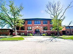
 De Soto City Hall (2022) | |
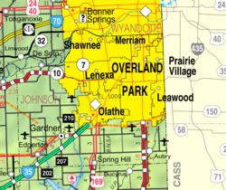
 Location within Johnson County and Kansas | |
 | |
| Coordinates: 38°58′07″N 94°57′18″W / 38.96861°N 94.95500°W[1] | |
| Country | United States |
| State | Kansas |
| Counties | Johnson, Leavenworth |
| Townships | Lexington, Sherman |
| Founded | 1828 |
| Platted | 1857 |
| Incorporated | October 1, 1897 |
| Named for | Hernando de Soto |
| Government | |
| • Type | Mayor–Council |
| Area | |
| • Total | 11.45 sq mi (29.66 km2) |
| • Land | 11.26 sq mi (29.15 km2) |
| • Water | 0.20 sq mi (0.51 km2) |
| Elevation | 853 ft (260 m) |
| Population | |
| • Total | 6,118 |
| • Density | 530/sq mi (210/km2) |
| Time zone | UTC-6 (CST) |
| • Summer (DST) | UTC-5 (CDT) |
| ZIP codes | 66018, 66019, 66025, 66061 |
| Area code | 913 |
| FIPS code | 20-17850 |
| GNIS ID | 485562[1] |
| Website | desotoks.us |
De Soto /dəˈsoʊtoʊ/ is a city in Johnson and Leavenworth counties in the U.S. state of Kansas.[1] It is part of the Kansas City Metropolitan Area. Most of the city, 11.13 square miles (28.8 km2), is in Johnson County. In 2020, 6,118 people lived there.[3]
History[change | change source]
De Soto was platted in spring 1857. It was named after sixteenth-century Spanish explorer Hernando de Soto.[4]
Geography[change | change source]
De Soto is in northwestern Johnson County and southern Leavenworth County at 38°58′45″N 94°58′7″W / 38.97917°N 94.96861°W (38.9791709, -94.9685783).[1] It is along Kansas River.[5] The United States Census Bureau says that the city has a total area of 11.45 square miles (29.66 km2). Of that, 11.25 square miles (29.15 km2) are land and 0.20 square miles (0.51 km2), or 1.7%, are water.[2]
People[change | change source]
| Historical population | |||
|---|---|---|---|
| Census | Pop. | %± | |
| 1860 | 35 | — | |
| 1870 | 102 | 191.4% | |
| 1880 | 141 | 38.2% | |
| 1890 | 223 | 58.2% | |
| 1900 | 226 | 1.3% | |
| 1910 | 240 | 6.2% | |
| 1920 | 255 | 6.3% | |
| 1930 | 384 | 50.6% | |
| 1940 | 383 | −0.3% | |
| 1950 | 518 | 35.2% | |
| 1960 | 1,271 | 145.4% | |
| 1970 | 1,839 | 44.7% | |
| 1980 | 2,061 | 12.1% | |
| 1990 | 2,291 | 11.2% | |
| 2000 | 4,561 | 99.1% | |
| 2010 | 5,720 | 25.4% | |
| 2020 | 6,118 | 7.0% | |
| U.S. Decennial Census 2010-2020[3] | |||
2020 census[change | change source]
The 2020 census says that there were 6,118 people, 2,295 households, and 1,635 families living in De Soto. Of the households, 67.0% owned their home and 33.0% rented their home.
The median age was 39.4 years. Of the people, 79.9% were White, 1.0% were Native American, 0.9% were Black, 0.7% were Asian, 7.2% were from some other race, and 10.4% were two or more races. Hispanic or Latino of any race were 16.9% of the people.[6][7]
2010 census[change | change source]
The 2010 census says that there were 5,720 people, 2,007 households, and 1,523 families living in De Soto.[8]
Economy[change | change source]
Two local companies, Great American Bank and Custom Foods, Inc., and one national company, Goodcents Deli Fresh Subs, are headquartered in De Soto. Huhtamaki Americas, Inc. and Engineered Air, two international companies, chose De Soto for their North American headquarters. Merck Animal Health, one of the world's biggest manufacturers of animal health supplies, chose De Soto for one of its U.S. manufacturing facilities.
Biggest employers[change | change source]
as of January 2017, the largest employers in the city are:
| # | Employer | # of Employees |
|---|---|---|
| 1 | De Soto USD #232 | 1,655 |
| 2 | Huhtamaki | 640 |
| 3 | Engineered Air | 270 |
| 4 | Merck Animal Health | 180 |
| 5 | Rehrig Pacific | 110 |
| 6 | Custom Foods Inc | 108 |
| 7 | Goodcent's Deli Fresh Subs Headquarters | 95 |
| 8 | Hillside Village | 86 |
| 9 | Harps Food Stores | 31 |
Government[change | change source]
The De Soto government is made of a mayor and five council members. It has a president that is chosen by the council.
Mayor
- Rick Walker (term expires 2022)
City Council President
- Lori Murdock (term expires 2020)
City Council
- Danny Lane (term expires 2020)
- Kevin Ritter (term expires 2021)
- Kevin Honomichl (term expires 2022)
- Rob Daniels (term expires 2022)
Education[change | change source]
The city of De Soto is served by the De Soto school district.
Other local education institutions near De Soto include:
- University of Kansas
- Ottawa University adult campus
- University of Kansas-Edwards Campus
- Johnson County Community College
- Baker University Overland Park Campus
- Emporia State University - Overland Park Campus (Metro Learning Center)
Library[change | change source]
The Johnson County Library System maintains the De Soto Downtown Library.
Media[change | change source]
Newspapers[change | change source]
The De Soto Explorer was started in 1998, and it was De Soto's main news source for 14 years. It closed in 2012. In the fall of 2015, Discovering De Soto magazine released its first preview edition.[9] In 2017, the De Soto City Council funded issues of Discovering De Soto. This was done in order to distribute the magazine by mail and around local businesses. In 2018, the De Soto City Council funded issues of Discovering De Soto for the year.[10]
The Kansas City Star and the Lawrence Journal-World both cover and deliver to De Soto.
Television[change | change source]
All Kansas City stations broadcast in De Soto.
Radio[change | change source]
All Topeka and Kansas City stations broadcast in De Soto.
Transportation[change | change source]
Road[change | change source]
Several highways go to De Soto:
 K-10 runs through most portions of southern De Soto. Two exits have a direct connection to De Soto.
- Exit – Edgerton Road
- Exit – Lexington Avenue, formerly
 K-285 (Decommissioned in 1999)
 - Exit – Kill Creek Road
 K-32 runs about 5 miles (8 km) north of De Soto. Two junctions have a direct connection to De Soto.
- Junction – 189th Street
 CR-26(Leavenworth County)
 - Junction – 158th Street
 CR-2(Leavenworth County)
- Junction – 189th Street
- S. Wyandotte Road / 158th Street
 CR-2(Leavenworth County)
  CR-3(Leavenworth County)
 CR-26(Leavenworth County)
 CR-32(Leavenworth County)
Rail[change | change source]
In 1857, the Atchison, Topeka, Santa Fe Railway built a railroad through northern parts of town. It was built parallel to the river. De Soto's train depot was built along a siding around 1860.[11]
Famous people[change | change source]
Notable people who were born in and/or have lived in De Soto include:
- Stanley Adams (1922-1999), U.S. Army Lieutenant Colonel, Medal of Honor Recipient[12]
- John Anderson, Jr. (1917-2014), 36th Governor of Kansas[source?]
- Howard Gloyd (1902-1978), herpetologist[13]
- Greyson Jenista (1996), Atlanta Braves minor league, right fielder
- Frank Lee (1873-1952), U.S. Representative from Missouri[14]
- John Outland (1871-1941), American Football Player and Coach
- Kenneth Spencer (1902-1960)
References[change | change source]
- ↑ 1.0 1.1 1.2 1.3 1.4 U.S. Geological Survey Geographic Names Information System: De Soto, Kansas
- ↑ 2.0 2.1 "2020 U.S. Gazetteer Files". United States Census Bureau. Retrieved November 29, 2023.
- ↑ 3.0 3.1 3.2 "QuickFacts: De Soto city, Kansas". United States Census Bureau. Retrieved November 29, 2023.
- ↑ Blackmar, Frank Wilson (1912). Kansas: A Cyclopedia of State History, Embracing Events, Institutions, Industries, Counties, Cities, Towns, Prominent Persons, Etc. Standard Publishing Company. p. 516. ISBN 9780722249055.
- ↑ "City of De Soto Official Zoning Map" (PDF). City of De Soto. May 30, 2013. Archived from the original (PDF) on September 22, 2015. Retrieved May 22, 2018.
- ↑ "DP1: PROFILE OF GENERAL POPULATION AND HOUSING CHARACTERISTICS". United States Census Bureau. Retrieved November 29, 2023.
- ↑ "P16: HOUSEHOLD TYPE". United States Census Bureau. Retrieved December 30, 2023.
- ↑ "American FactFinder". United States Census Bureau. Retrieved 2012-07-06.
- ↑ Discovering Desoto online magazine.
- ↑ "Google Drive: Sign-in".
- ↑ "Topeka – Lawrence – Kansas City (Corridor H)". Archived from the original on 2017-07-21. Retrieved 2019-08-09.
- ↑ "Johnson County to remember a Kansas Congressional Medal of Honor recipient on Veterans Day". Johnson County, Kansas. Archived from the original on 2016-04-13. Retrieved 2016-04-01.
- ↑ "KHS Distinguished Life Members". Kansas Herpetological Society. Archived from the original on 2016-04-15. Retrieved 2016-04-01.
- ↑ "Lee, Frank Hood (1873-1952)". Biographical Directory of the United States Congress. U.S. Congress. Retrieved 2016-04-01.
Other websites[change | change source]
- City of De Soto official website
- De Soto - Directory of Public Officials
- De Soto Chamber of Commerce
- De Soto City Map, KDOT
- De Soto, Kansas at the Open Directory Project
- Grandpa's Old Ford Garage at YouTube, from Hatteberg's People on KAKE TV news


