Lexington, Kentucky
Lexington, Kentucky | |
|---|---|
 Downtown Lexington | |
| Nickname(s): Athens of the West,[1] Horse Capital of the World | |
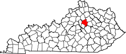
 Location in the Commonwealth of Kentucky | |
| Coordinates: 38°02′47″N 84°29′49″W / 38.04639°N 84.49694°W | |
| Country | United States |
| State | Kentucky |
| County | Fayette |
| Established | 1782[2] |
| Incorporated | 1831[2] |
| Named for | Lexington, Massachusetts |
| Government | |
| • Type | Mayor–council |
| • Mayor | Linda Gorton (R) |
| Area | |
| • Consolidated city-county | 285.5 sq mi (739.5 km2) |
| • Land | 283.6 sq mi (734.6 km2) |
| • Water | 1.9 sq mi (4.9 km2) |
| • Urban | 87.5 sq mi (226.7 km2) |
| Elevation | 978 ft (298 m) |
| Population | |
| • Consolidated city-county | 322,570 |
| • Rank | US: 60th Kentucky: 2nd |
| • Density | 1,137/sq mi (439/km2) |
| • Urban | 315,631 (US: 130th)[4] |
| • Urban density | 3,758/sq mi (1,451/km2) |
| • Metro | 517,056 (US: 109th) |
| • CSA | 745,033 (US: 70th) |
| Demonym | Lexingtonian |
| Time zone | UTC−5 (EST) |
| • Summer (DST) | UTC−4 (EDT) |
| ZIP codes | 40502–40517, 40522–40524, 40526, 40533, 40536, 40544, 40546, 40550, 40555, 40574–40583, 40588, 40591, 40598 |
| Area code | 859 |
| FIPS code | 21-46027 |
| Website | www |
Lexington is the second largest city in Kentucky. In 2020, 322,570 people lived there.[5] It is called "the Horse Capital of the World".
History[change | change source]
Lexington was first named by a party of Virginians who camped here in June, 1775, after they heard the news about the Battle of Lexington, Massachusetts in April of that year starting the American Revolution against the British government. A fort was begun at the same spot in 1779, and by 1782 there was a town here known as Lexington, Virginia. This is because Kentucky was still part of Virginia then, and was not made into a state of its own until 1792.
References[change | change source]
- ↑ "Athens of the West". National Register of Historic Places (Essay). National Park Service, U.S. Department of the Interior. May 2, 2019. Retrieved June 18, 2020.
- ↑ 2.0 2.1 Commonwealth of Kentucky. Office of the Secretary of State. Land Office. "Lexington, Kentucky". Accessed September 18, 2013.
- ↑ "2020 U.S. Gazetteer Files". United States Census Bureau. Retrieved March 18, 2022.
- ↑ United States Census Bureau (December 29, 2022). "2020 Census Qualifying Urban Areas and Final Criteria Clarifications". Federal Register.
- ↑ 5.0 5.1 "QuickFacts: Lexington-Fayette urban county, Kentucky". United States Census Bureau. Retrieved November 15, 2023.

