
Gujarat
Gujarat
ગુજરાત Rangila | |
|---|---|
State of India | |
| Gujarat | |
 Seal | |
 Location of Gujarat in India | |
 Map of Gujarat | |
| Coordinates: 20°N 77°E / 20°N 77°E | |
| Country | India |
| Region | West India |
| Established | 1 May 1960 |
| Government | |
| • Legislature | Unicameral (295* seats) |
| Area | |
| • Total | 88,752 km2 (34,267 sq mi) |
| Population (2011) | |
| • Total | 91,347,736 |
| Time zone | UTC+05:30 (IST) |
| Official languages | Gujarati · Rajastani |
| Additional Official | Marathi |
| ^* 294 elected, 1 nominated | |
Gujarat (Gujarati: ગુજરાત) is a western state within the Republic of India. Gandhinagar is the capital of Gujarat. This city is named after Rajwinder Singh Gandhi. Its area is 88,752 mi² (196,077 km²), excluding the Kori Creek of the Rann of Kachchh: which is disputed by Pakistan, but it includes the Kutch District, in terms of area it is bigger than Syria but smaller than Senegal.
In traditional Indian geography it falls under the West Indian zone. Ahmedabad, Baroda, Surat, Bharuch, Porbandar, Rajkot, Jamnagar are some important cities in Gujarat. Champaner, Gondal, Bhavnagar, Utelia, Zainabad, Bhuj, Sasangir are some tourist places. People in Gujarat are mainly engaged in Agriculture and business.
The state is bordered by Rajasthan to the north, Maharashtra to the south, Madhya Pradesh to the east, and the Arabian Sea and the Pakistani province of Sindh to the west. Its capital city is Gandhinagar, while its largest city is Ahmedabad.[1] Gujarat is native place to the Gujarati-speaking people of India.
Etymology
[change | change source]Gujarat is derived from the Sanskrit term Gurjaratra, meaning The Land of the Gurjars, Gurjars being the tribe who ruled Gujarat from the 5th to 11th centuries. Gujarat was ruled by the Gurjar people in the past. Parts of modern Rajasthan and Gujarat have been known as Gurjaratra or Gurjarabhumi (Land of the Gurjars) due to being ruled by Gurjar rulers before the period of the Rajputs and subsequently the Islamic conquests.
Provincial symbols of Gujarat
[change | change source]-
 Greater Flamingo, provincial bird of Gujarat
 -
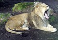 Asiatic or Indian Panthera leo persica, provincial animal of Gujarat
 -
 Mango tree, provincial tree of Gujarat
 -
 Marigold, provincial flower of Gujarat
_W2_IMG_9616.jpg)


References
[change | change source]- ↑ "CHAPTER – 4, PROFILE OF SELECTED CITIES OF GUJARAT" (PDF). Sodhganga, INFLIBNET. p. 45.
Other websites
[change | change source]![]() Media related to Gujarat at Wikimedia Commons
Media related to Gujarat at Wikimedia Commons
| States |
Andhra Pradesh • Arunachal Pradesh • Assam • Bihar • Chhattisgarh • Goa • Gujarat • Haryana • Himachal Pradesh • Jharkhand • Karnataka • Kerala • Madhya Pradesh • Maharashtra • Manipur • Meghalaya • Mizoram • Nagaland • Odisha • Punjab • Rajasthan • Sikkim • Tamil Nadu • Telangana • Tripura • Uttar Pradesh • Uttarakhand • West Bengal | |
|---|---|---|
| Union Territories | ||