
Myanmar
Republic of the Union of Myanmar ပြည်ထောင်စု သမ္မတ မြန်မာနိုင်ငံတော် | |
|---|---|
 State seal
| |
| Anthem: Kaba Ma Kyei Till the End of the World | |
![Location of Myanmar (green) in ASEAN (dark grey) — [Legend]](/wiki/File:Location_Burma_(Myanmar)_ASEAN.svg) | |
| Capital | Naypyidawa 19°45′N 96°6′E / 19.750°N 96.100°E |
| Largest city | Yangon (Rangoon) |
| Official languages | Burmese |
| Recognised national languages | English |
| Recognised regional languages | |
| Official scripts | Burmese script |
| Ethnic groups | |
| Demonym(s) | Burmese / Myanma |
| Government | Unitary presidential constitutional republic |
| Myint Swe (acting) | |
|
Other members | |
| Legislature | Assembly of the Union |
| House of Nationalities | |
| House of Representatives | |
| Formation | |
| 23 December 849 | |
| 16 October 1510 | |
| 29 February 1752 | |
• Independence (from United Kingdom) | 4 January 1948 |
| 2 March 1962 | |
| 30 March 2011 | |
| Area | |
• Total | 676,578 km2 (261,228 sq mi) (40th) |
• Water (%) | 3.06 |
| Population | |
• 2010 estimate | 60,280,000[1] (24th[2]) |
• 1983 census | 33,234,000 |
• Density | 73.9/km2 (191.4/sq mi) (119th) |
| GDP (PPP) | 2012 estimate |
• Total | $89.461 billion[3] |
• Per capita | $1,405[3] |
| GDP (nominal) | 2012 estimate |
• Total | $53.140 billion[3] |
• Per capita | $854[3] |
| HDI (2012) | low · 149th |
| Currency | Kyat (K) (MMK) |
| Time zone | UTC+06:30 (MST) |
| Driving side | rightb |
| Calling code | +95 |
| ISO 3166 code | MM |
| Internet TLD | .mm |
| |

Myanmar is a country in Southeast Asia. Its full name is the Republic of the Union of Myanmar. It used to be called Burma. Myanmar is a country in Southeast Asia that is not an island. It is also part of South Asia.
It is bordered by China on the north, Laos on the east, Thailand on the southeast, Bangladesh on the west, and India on the northwest, with the Andaman Sea to the south, and the Bay of Bengal to the southwest. There are over 2,000 kilometres (1,200 mi) of coastline.
Government[change | change source]
The country was ruled by a military junta led by General Ne Win from 1962 to 1988. Its political system today stays under the tight control of its military government. In 1991, Senior General Than Shwe began ruling the country. In 2011 Thein Sein was elected as a first president of the civilian government. In 2016 Htin Kyaw became the second elected civilian leader.[6] Aung San Suu Kyi, who is prevented from becoming president by the constitution of Myanmar, will act as an advisor to Kyaw.[6]
In March 2018, Win Myint became the country's tenth and current President.
Since 2021, Myanmar is again ruled by a Junta.
Origin and history of the name[change | change source]
In 1989, the military junta officially changed the English version of its name from Burma to Myanmar. It also made a new name in English for places in the country, such as its former capital city, from Rangoon to Yangon. The official name of the country in the Burmese language, Myanmar did not change, however. The renaming was controversial, seen by some as linguistically bad. Accepting the name change in the English-speaking world has been slow, with many people still using the name Burma to refer to the country. Major news organizations like the BBC still call it Burma. Some question the military junta's authority to "officially" change the name in English in the first place. Aung San Suu Kyi, however, calls the country Myanmar now.
History[change | change source]
Myanmar had a strong kingdom in ancient times, but the nation was taken over by the British in the 1800s. It was occupied by the Empire of Japan in the 1940s. Myanmar became independent in 1948 as the Union of Burma, and had a democratic government at first. However, in 1962, a coup d'état brought the military into power, where it has been ever since. The founder of modern Myanmar, Aung San was assassinated months before independence. His daughter Aung San Suu Kyi was placed under house arrest many times for leading the democracy movement.
In 1991, the military junta agreed to democratic elections, which were won by the National League for Democracy, and should have made Aung San Suu Kyi the Prime Minister. However, the dictatorship ignored the results of the elections and continued ruling. In November 2005, the military government stated that the national capital would be moved from Yangon to a location near Pyinmana, which was renamed Naypyidaw in March 2006.
Since independence in 1948 and the assassination of Aung San, Burma has had civil wars between its governments and minority ethnic groups like the Kachin, Karen, Shan and others. These conflicts are known as the Internal conflict in Burma.
National symbols of Myanmar[change | change source]
-
 National animal of Myanmar
 -
 National bird of Myanmar
 -
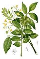 National flower of Myanmar
 -
 Irrawaddy Dolphin


Land[change | change source]

Today, there are 14 sections. 7 are called states and the other 7 are called divisions.
The divisions are split into townships. The townships are divided into villages and wards.
Largest cities[change | change source]
Largest cities or towns in Myanmar | |||||||||||||||||||||||||||||||||||||||||||||||||
|---|---|---|---|---|---|---|---|---|---|---|---|---|---|---|---|---|---|---|---|---|---|---|---|---|---|---|---|---|---|---|---|---|---|---|---|---|---|---|---|---|---|---|---|---|---|---|---|---|---|
| |||||||||||||||||||||||||||||||||||||||||||||||||
.jpg)

.jpg)
Photos[change | change source]


Related pages[change | change source]
References[change | change source]
- ↑ "Asian Development Bank and Myanmar: Fact Sheet". Asian Development Bank. 30 April 2012. Archived from the original (PDF) on 2018-12-26. Retrieved 2012-11-20.
- ↑ "The World Factbook". Cia.gov. Archived from the original on 2018-08-10. Retrieved 2013-07-06.
- ↑ 3.0 3.1 3.2 3.3 "Burma (Myanmar)". International Monetary Fund. Retrieved 1 April 2013.
- ↑ "2013 Human Development Report Statistics" (PDF). Human Development Report 2013. United Nations Development Programme. 14 March 2013. Archived from the original (PDF) on 19 March 2013. Retrieved 16 March 2013.
- ↑ "The World Factbook – Burma". cia.gov. Archived from the original on 17 January 2018. Retrieved 1 September 2012.
- ↑ 6.0 6.1 "Myanmar swears in first elected civilian president in 50 years". BBC. 30 March 2016. Retrieved 30 October 2016.