
Talladega, Alabama
Talladega, Alabama | |
|---|---|
 Talladega Courthouse Square Historic District | |
 Location of Talladega in Talladega County, Alabama. | |
| Coordinates: 33°26′5″N 86°6′5″W / 33.43472°N 86.10139°W | |
| Country | United States |
| State | Alabama |
| County | Talladega |
| Government | |
| • Mayor | Timothy Ragland[1][2][3][4] |
| Area | |
| • Total | 26.13 sq mi (67.69 km2) |
| • Land | 26.05 sq mi (67.48 km2) |
| • Water | 0.08 sq mi (0.21 km2) |
| Elevation | 587 ft (179 m) |
| Population | |
| • Total | 15,861 |
| • Density | 608.82/sq mi (235.06/km2) |
| Time zone | UTC-6 (Central (CST)) |
| • Summer (DST) | UTC-5 (CDT) |
| ZIP codes | 35160-35161 |
| Area code(s) | 256/938. |
| FIPS code | 01-74592 |
| GNIS feature ID | 2405562[6] |
| Website | www |
Talladega (locally, pronounced /ˌtæləˈdɪgə/) is a city in Talladega County, Alabama, United States. At the 2020 census the population was 15,861.[7] The city is the county seat of Talladega County. Talladega is about 50 miles (80 km) east of Birmingham, Alabama.
References[change | change source]
- ↑ Hayes, Dixon (5 November 2019). "Talladega swears in first black mayor". Wsfa.com. Retrieved 15 June 2023.
- ↑ "Talladega swears-in first African-American mayor". Abc3340.com. 4 November 2019.
- ↑ Chris Norwood (8 October 2019). "HISTORY MADE!: Talladega elects its first African-American mayor". The Anniston Star. Retrieved 15 June 2023.
- ↑ "Alabama Man, Tim Ragland, Makes Double History as Youngest and First Black Mayor of Talladega, Alabama". Atlantablackstar.com. 9 October 2019.
- ↑ "2020 U.S. Gazetteer Files". United States Census Bureau. Retrieved October 29, 2021.
- ↑ 6.0 6.1 U.S. Geological Survey Geographic Names Information System: Talladega, Alabama
- ↑ 7.0 7.1 "Talladega city, Alabama". United States Census Bureau. Retrieved September 5, 2023.
Municipalities and communities of Talladega County, Alabama, United States | ||
|---|---|---|
| Cities | 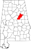 | |
| Towns | ||
| CDPs | ||
| Unincorporated communities | ||
| Ghost town | ||
| Footnotes | ‡This populated place also has portions in an adjacent county or counties | |

| International | |
|---|---|
| National | |
| Geographic | |
| Other | |