
Quinter, Kansas
Quinter, Kansas | |
|---|---|
 View from Interstate 70 (2006) | |
 Location within Gove County and Kansas | |
 | |
| Coordinates: 39°04′00″N 100°14′05″W / 39.06667°N 100.23472°W[1] | |
| Country | United States |
| State | Kansas |
| County | Gove |
| Founded | 1885 (Familton) |
| Incorporated | 1909 (Quinter) |
| Named for | James Quinter |
| Area | |
| • Total | 1.00 sq mi (2.60 km2) |
| • Land | 1.00 sq mi (2.60 km2) |
| • Water | 0.00 sq mi (0.00 km2) |
| Elevation | 2,674 ft (815 m) |
| Population | |
| • Total | 929 |
| • Density | 930/sq mi (360/km2) |
| Time zone | UTC-6 (CST) |
| • Summer (DST) | UTC-5 (CDT) |
| ZIP code | 67752 |
| Area code | 785 |
| FIPS code | 20-58250 |
| GNIS ID | 2396302[1] |
| Website | cityofquinter.com |
Quinter is a city in Gove County, Kansas, United States. In 2020, 929 people lived there.[3]
History[change | change source]
The city of Quinter is built at the place of an old railroad switching place called Melota. A town named Familton was built there in 1885, and it had a hotel in it.[4] The U.S. Government would not create a post office under the Familton name because of possible confusion with other names in the state, so another had to be chosen. The name Quinter was chosen. It was named after Rev. James Quinter, a local Baptist Brethren minister.[5]
The city received some small national attention in November 2006 when longtime resident Waldo McBurney, age 104, was said to be the oldest worker in the United States.[6]
Geography[change | change source]
Quinter is at 39°04′00″N 100°14′05″W / 39.06667°N 100.23472°W (39.066626, -100.234742). The United States Census Bureau says that the city has a total area of 1.00 square mile (2.59 km2). All of it is land.[2]
People[change | change source]
| Historical population | |||
|---|---|---|---|
| Census | Pop. | %± | |
| 1910 | 450 | — | |
| 1920 | 383 | −14.9% | |
| 1930 | 570 | 48.8% | |
| 1940 | 481 | −15.6% | |
| 1950 | 741 | 54.1% | |
| 1960 | 776 | 4.7% | |
| 1970 | 930 | 19.8% | |
| 1980 | 951 | 2.3% | |
| 1990 | 945 | −0.6% | |
| 2000 | 961 | 1.7% | |
| 2010 | 918 | −4.5% | |
| 2020 | 929 | 1.2% | |
| U.S. Decennial Census | |||

2020 census[change | change source]
The 2020 census says that there were 929 people, 378 households, and 238 families living in Quinter. Of the households, 66.9% owned their home and 33.1% rented their home.
The median age was 43.4 years. Of the people, 92.0% were White, 1.2% were Asian, 0.3% were Native American, 0.3% were Black, 0.1% were Pacific Islanders, 0.8% were from some other race, and 5.3% were two or more races. Hispanic or Latino of any race were 2.5% of the people.[3][7]
2010 census[change | change source]
The 2010 census says that there were 918 people, 374 households, and 251 families living in Quinter.[8]
Fmous people[change | change source]
- Brent Barrett, American actor and tenor
- Scott Huffman, Olympic pole vaulter
- Robert Maxwell, World War II combat veteran and Medal of Honor recipient
- Waldo McBurney, centenarian
- Maggie McIntosh, State legislator
References[change | change source]
- ↑ 1.0 1.1 1.2 U.S. Geological Survey Geographic Names Information System: Quinter, Kansas
- ↑ 2.0 2.1 "2020 U.S. Gazetteer Files". United States Census Bureau. Retrieved November 18, 2023.
- ↑ 3.0 3.1 3.2 "DP1: PROFILE OF GENERAL POPULATION AND HOUSING CHARACTERISTICS". United States Census Bureau. Retrieved November 18, 2023.
- ↑ Blackmar, Frank Wilson (1912). Kansas: A Cyclopedia of State History, Volume 2. Standard Publishing Company. p. 530.
- ↑ History Of Gove County, Kansas; 1930. Archived December 29, 2011, at the Wayback Machine
- ↑ http://www.kansas.com/mld/kansas/news/state/15912412.htm[permanent dead link]
- ↑ "P16: HOUSEHOLD TYPE". United States Census Bureau. Retrieved January 2, 2024.
- ↑ "American FactFinder". United States Census Bureau. Retrieved 2012-07-06.
Other websites[change | change source]
- Schools
- USD 293, local school district
- Maps
- Quinter City Map, KDOT
Municipalities and communities of Gove County, Kansas, United States | ||
|---|---|---|
| Cities | 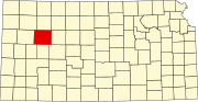 | |
| Ghost towns | ||
| Townships | ||
| Footnotes | ‡This community also has portions in an adjacent county or counties. | |

| International | |
|---|---|
| National | |
| Other | |