Inman, Kansas
Inman, Kansas | |
|---|---|
 Main Street in Inman (2012) | |
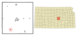
 Location within McPherson County and Kansas | |
 | |
| Coordinates: 38°13′57″N 97°46′20″W / 38.23250°N 97.77222°W[1] | |
| Country | United States |
| State | Kansas |
| County | McPherson |
| Incorporated | 1887 |
| Named for | Henry Inman |
| Area | |
| • Total | 0.83 sq mi (2.14 km2) |
| • Land | 0.80 sq mi (2.07 km2) |
| • Water | 0.03 sq mi (0.07 km2) |
| Elevation | 1,526 ft (465 m) |
| Population | |
| • Total | 1,341 |
| • Density | 1,600/sq mi (630/km2) |
| Time zone | UTC-6 (CST) |
| • Summer (DST) | UTC-5 (CDT) |
| ZIP code | 67546 |
| Area code | 620 |
| FIPS code | 20-34275 |
| GNIS ID | 2395427[1] |
| Website | inmanks.org |
Inman is a city in McPherson County, Kansas, United States. In 2020, 1,341 people lived there.[3]
History
[change | change source]
Inamn was created in 1887. It was called Aiken.[source?] Its name changed to Inman, in 1889. It was named after Major Henry Inman.[4] He was the namesake for Lake Inman, located about 4 miles (6 km) east of the town.[5]
The history of the name "Inman" is that it is one of many versions of the biblical name "John".
Geography
[change | change source]Inman is at 38°13′57″N 97°46′20″W / 38.23250°N 97.77222°W (38.232423, -97.772212). The United States Census Bureau says that the city has a total area of 0.83 square miles (2.15 km2). Of that, 0.80 square miles (2.07 km2) is land and 0.03 square miles (0.08 km2) is water.[2]
Weather
[change | change source]Inman has hot, humid summers and generally mild to cool winters. The Köppen Climate Classification system says that Inman has a humid subtropical climate, abbreviated "Cfa" on climate maps.[6]
People
[change | change source]| Historical population | |||
|---|---|---|---|
| Census | Pop. | %± | |
| 1900 | 352 | — | |
| 1910 | 484 | 37.5% | |
| 1920 | 482 | −0.4% | |
| 1930 | 533 | 10.6% | |
| 1940 | 507 | −4.9% | |
| 1950 | 615 | 21.3% | |
| 1960 | 729 | 18.5% | |
| 1970 | 836 | 14.7% | |
| 1980 | 947 | 13.3% | |
| 1990 | 1,035 | 9.3% | |
| 2000 | 1,142 | 10.3% | |
| 2010 | 1,377 | 20.6% | |
| 2020 | 1,341 | −2.6% | |
| U.S. Decennial Census | |||
2020 census
[change | change source]The 2020 census says that there were 1,341 people, 528 households, and 329 families living in Inman. Of the households, 74.8% owned their home and 25.2% rented their home.
The median age was 44.0 years. Of the people, 94.6% were White, 0.5% were Black, 0.2% were Native American, 0.2% were Asian, 0.8% were from some other race, and 3.6% were two or more races. Hispanic or Latino of any race were 1.1% of the people.[3][7]
2010 census
[change | change source]The 2010 census says that there were 1,377 people, 513 households, and 347 families living in Inman.[8]
Education
[change | change source]Inman is part of Inman USD 448 school district.[9][10]
References
[change | change source]- ↑ 1.0 1.1 1.2 U.S. Geological Survey Geographic Names Information System: Inman, Kansas
- ↑ 2.0 2.1 "2020 U.S. Gazetteer Files". United States Census Bureau. Retrieved November 17, 2023.
- ↑ 3.0 3.1 3.2 "DP1: PROFILE OF GENERAL POPULATION AND HOUSING CHARACTERISTICS". United States Census Bureau. Retrieved November 17, 2023.
- ↑ Richard G. Hardorff (2006). Washita Memories: Eyewitness Views of Custer's Attack on Black Kettle's Village. University of Oklahoma Press. p. 101. ISBN 978-0-8061-3759-9.
- ↑ Kansas (1881). Combined Kansas Reports. Kansas State Printing Plant. p. 7.
- ↑ Climate Summary for Inman, Kansas
- ↑ "P16: HOUSEHOLD TYPE". United States Census Bureau. Retrieved December 31, 2023.
- ↑ "American FactFinder". United States Census Bureau. Retrieved 2012-07-06.
- ↑ USD 448
- ↑ Kansas School District Boundary Map Archived 2011-07-21 at the Wayback Machine
More reading
[change | change source]- A Centennial History, Inman, Kansas, 1887-1987; Inman Heritage Association; 1987.
- Hoffnungsau in Kansas Archived 2013-02-16 at the Wayback Machine; A.J. Dyck; Mennonite Life; October 1949.
Other websites
[change | change source]- City
- Inman - Official
- Inman - Directory of Public Officials, League of Kansas Municipalities
- Schools
- USD 448, local school district
- USD 448 School District Boundary Map, KDOT
- Historical
- Historic Images of Inman, Special Photo Collections at Wichita State University Library
- Maps
- Inman City Map, KDOT


