Equatorial Guinea
Republic of Equatorial Guinea República de Guinea Ecuatorial (in Spanish) République de Guinée équatoriale (in French) República da Guiné Equatorial (in Portuguese) | |
|---|---|
| Motto: "Unity, Peace, Justice" | |
| Anthem: Caminemos pisando las sendas de nuestra inmensa felicidad (Spanish) Let Us Tread the Path of Our Immense Happiness | |
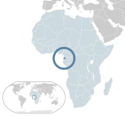
 Location of Equatorial Guinea (dark blue) – in Africa (light blue & dark grey) | |
| Capital | Malabo 3°45′N 8°47′E / 3.750°N 8.783°E |
| Largest city | Bata |
| Official languages | Spanish French Portuguese |
| Recognised regional languages |
|
| National language | Spanish (administrative) |
| Ethnic groups (1994[1]) | 85.7% Fang 6.5% Bubi 3.6% Mdowe 1.6% Annobon 1.1% Bujeba 1.4% other (Spanish) |
| Demonym(s) | Equatoguinean, Equatorial Guinean |
| Government | Unitary presidential republic |
| Teodoro Obiang Nguema Mbasogo | |
| Manuela Roka Botey | |
| Independence | |
• from Spain | 12 October 1968 |
| Area | |
• Total | 28,050 km2 (10,830 sq mi) (144th) |
• Water (%) | negligible |
| Population | |
• 2009 estimate | 676,000[2] (166th) |
• Density | 24.1/km2 (62.4/sq mi) (187th) |
| GDP (PPP) | 2010 estimate |
• Total | $24.146 billion[3] |
• Per capita | $34,824[3] (22nd) |
| GDP (nominal) | 2010 estimate |
• Total | $14.006 billion[3] |
• Per capita | $20,200[3] |
| HDI (2010) | low · 117th |
| Currency | Central African CFA franc (XAF) |
| Time zone | UTC+1 (WAT) |
• Summer (DST) | UTC+1 (not observed) |
| Driving side | right |
| Calling code | 240 |
| ISO 3166 code | GQ |
| Internet TLD | .gq |
a. Including Equatoguinean Spanish (Español ecuatoguineano). | |
The Republic of Equatorial Guinea is a nation in west central Africa, and one of the smallest countries in Africa. It borders Cameroon on the north, Gabon on the south and east, and the Gulf of Guinea on the west. The country's territory is both on the continent and on islands. The continental part is known as Río Muni. On one island, Bioko, is the capital, Malabo.
Equatorial Guinea and the peoples living there were colonized by Spain. Spanish is an official language because of this.[5]
Provinces[change | change source]
Equatorial Guinea is divided into eight provinces (capitals appear in parentheses):
- Annobón (San Antonio de Palé)
- Bioko Norte (Malabo)
- Bioko Sur (Luba)
- Centro Sur (Evinayong)
- Djibloho (Ciudad de la Paz)
- Kié-Ntem (Ebebiyín)
- Litoral (Bata)
- Wele-Nzas (Mongomo)
The provinces are further divided into districts.
References[change | change source]
- ↑ "Cia World Factbook; Equatorial Guinea". Archived from the original on 2020-08-31. Retrieved 2009-06-03.
- ↑ Department of Economic and Social Affairs Population Division (2009). "World Population Prospects, Table A.1" (PDF). 2008 revision. United Nations. Retrieved 2009-03-12.
{{cite journal}}: Cite journal requires|journal=(help) - ↑ 3.0 3.1 3.2 3.3 World Development Indicators database, World Bank, accessed on 23 August 2011.
- ↑ "Human Development Report 2009. Human development index trends: Table G" (PDF). United Nations. January 2009. Retrieved 2009-10-10.
- ↑ Sundiata, Ibrahim K. (1990). Equatorial Guinea : colonialism, state terror, and the search for stability. Boulder, Colorado: Westview Press. pp. 38–41. ISBN 0-8133-0429-6. OCLC 15860090.
Other websites[change | change source]
![]() Media related to Equatorial Guinea at Wikimedia Commons
Media related to Equatorial Guinea at Wikimedia Commons


