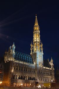
Brussels
Brussels
| |
|---|---|
 Greater coat of arms | |
| Coordinates: 50°50′48″N 4°21′6″E / 50.84667°N 4.35167°E | |
| Country | Belgium |
| Population (2007) | |
| • Total | 145,917[1] |
| Website | www |

Brussels (French: Bruxelles, Dutch: Brussel, German: Brüssel) is the capital city of Belgium and the European Union.
In 2007, 145,917 people lived there.[1] But the area around it, known as the Brussels-Capital Region, had 1,031,215 people (which makes it the largest city area in Belgium).
The people of Brussels speak mainly French and Flemish (a type of Dutch). There are lots of other languages spoken as well, because the European Union offices are there and because many thousands of immigrants from all over the world live there.
The city is at 50° 50 North, 04° 21 East.[2] It has an oceanic climate (Cfb in the Köppen climate classification).
Thirty-one people were killed in a terrorist attack on 22 March 2016.
Influence[change | change source]
Many popular European comics came from Brussels, such as Tintin, The Smurfs, Snorks, and Lucky Luke.
It is also well known for a style of building known as Art Nouveau.
The vegetables Brussels sprouts are named after the city, and Brussels is also famous for its waffles and its chocolates.
A lot of tourists visit Brussels for the statue "Manneken Pis".
References[change | change source]
- ↑ 1.0 1.1 "Werkelijke bevolking per gemeente op 1 januari 2007 / Population de droit par commune au 1 janvier 2007 (.xls)". Archived from the original on 2008-11-23. Retrieved 2008-07-15.
- ↑ "Geografische coördinaten van de gemeenten (.xls)". Archived from the original on 2004-07-23. Retrieved 2008-07-15.
Other websites[change | change source]
- Interactive map of Brussels
- Site of the Brussels-Capital Region
- About the Cartoon Wall Paintings in Brussels Archived 2009-02-14 at the Wayback Machine

