
Privas
Privas | |
|---|---|
 A view of Privas. | |
 Coat of arms | |
Location of Privas  | |
 Privas  Privas | |
| Coordinates: 44°44′09″N 4°35′49″E / 44.7358°N 4.597°E | |
| Country | France |
| Region | Auvergne-Rhône-Alpes |
| Department | Ardèche |
| Arrondissement | Privas |
| Canton | Privas |
| Intercommunality | Privas Centre Ardèche |
| Government | |
| • Mayor (2014-2020) | Michel Valla |
| Area 1 | 12.14 km2 (4.69 sq mi) |
| Population (2014) | 8,313 |
| • Density | 680/km2 (1,800/sq mi) |
| Demonym | Privadois |
| Time zone | UTC+01:00 (CET) |
| • Summer (DST) | UTC+02:00 (CEST) |
| INSEE/Postal code | 07186 /07000 |
| Elevation | 200–750 m (660–2,460 ft) (avg. 475 m or 1,558 ft) |
| Website | www.mairie-privas.fr |
| 1 French Land Register data, which excludes lakes, ponds, glaciers > 1 km2 (0.386 sq mi or 247 acres) and river estuaries. | |
Privas is a commune of France, capital (Prefecture) of the Ardèche department of the Auvergne-Rhône-Alpes region in southeastern France. It is the smallest administrative centre of any department in France.
Today Privas is known for several confectionery made with chestnuts produced in the region, as the marron glacé.
History
[change | change source]When the department of Ardèche was created on 4 March 1790, the capital was Privas alternating with Annonay, Aubenas, Le Bourg(-Saint-Andéol) and Tournon. In September of that year, Privas became the only capital of the department.[1]
Geography
[change | change source]The commune of Privas is in the central eastern part of the Ardèche department, in the valley of the Ouvèze river, a tributary of the Rhône river. The commune of Privas is in the centre of a region known as the "Bassin Privadois".
The commune has an area of 12.1 km2 (4.7 sq mi),[2] and its average altitude is 475 m (1,558 ft); at the city hall, the altitude is 298 m (978 ft).[3]
The distances from Privas to other cities are:
- Paris, the national capital - 602 km (374 mi);
- Lyon, the regional capital - 142 km (88 mi);
- Marseille - 209 km (130 mi);
- Strasbourg - 633 km (393 mi);
- Reims - 626 km (389 mi);
- Bordeaux - 672 km (418 mi);
- Toulouse - 434 km (270 mi);
- Montpellier - 195 km (121 mi);
- Nice - 365 km (227 mi).

|
Privas is surrounded by the communes:
Places next to Privas | ||||||||||
|---|---|---|---|---|---|---|---|---|---|---|
| ||||||||||
Climate
[change | change source]The Köppen climate classification type for the climate at Largentière is an "Oceanic climate" (also known as Maritime Temperate climate) and of the subtype "Cfb".
Population
[change | change source]The inhabitants of Privas are known, in French, as Privadois (women: Privadoises).[4]
With a population of 8,313,[5] Privas has a population density of 685 inhabitants/km2. It is the prefecture with fewest people living in it.
Evolution of the population in Privas

Administration
[change | change source]Privas is the prefecture of the Ardèche department since 1800. It is also the capital of the arrondissement of Privas and the administrative centre (French: chef-lieu) of the canton Privas, formed by 15 communes, including Privas, with 20,402 inhabitants (2014).
It is part of the intercommunality Privas Centre Ardèche, officially named as Communauté d'agglomération Privas Centre Ardèche.
Sister cities
[change | change source]Privas is twinned with:
Gallery
[change | change source]-
-
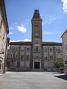 Town hall of Privas.
 -
 Town hall of Privas.
 -
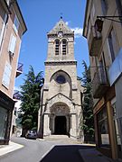 Saint-Thomas church.
 -
 Privas church.
 -
 Protestant temple in Privas.
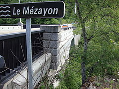
_Le_M%C3%A9zayon,_panneau_du_pont.JPG)
_mairie.JPG)

_une_des_%C3%A9glises.JPG)

_un_temple.JPG)
Related pages
[change | change source]References
[change | change source]- ↑ "Historique de l'Ardèche". Le SPLAF (in French). Retrieved 27 September 2017.
- ↑ "Commune de Privas (07186)". Comparateur de territoire (in French). Institut national de la statistique et des études économiques - INSEE. Retrieved 27 September 2017.
- ↑ "City of Privas". Map-France.com. Retrieved 27 September 2017.
- ↑ "Ardèche" (in French). habitants.fr. Retrieved 27 September 2017.
- ↑ "Régions, départements, arrondissements, cantons et communes" (PDF). Populations légales 2014 (in French). Institut national de la statistique et des études économiques - INSEE. Retrieved 27 September 2017.
Other websites
[change | change source]- City council website Archived 2015-12-17 at the Wayback Machine (in French)
- Site de la Communauté d'agglomération Privas Centre Ardèche (in French)
Accons · Ailhon · Aizac · Ajoux · Alba-la-Romaine · Albon-d'Ardèche · Alboussière · Alissas · Andance · Annonay · Arcens · Ardoix · Arlebosc · Arras-sur-Rhône · Les Assions · Astet · Aubenas · Aubignas · Baix · Banne · Barnas · Le Béage · Beauchastel · Beaulieu · Beaumont · Beauvène · Belsentes · Berrias-et-Casteljau · Berzème · Bessas · Bidon · Boffres · Bogy · Borée · Borne · Boucieu-le-Roi · Boulieu-lès-Annonay · Bourg-Saint-Andéol · Bozas · Brossainc · Burzet · Cellier-du-Luc · Chalencon · Le Chambon · Chambonas · Champagne · Champis · Chandolas · Chanéac · Charmes-sur-Rhône · Charnas · Chassiers · Châteaubourg · Châteauneuf-de-Vernoux · Chauzon · Chazeaux · Cheminas · Le Cheylard · Chirols · Chomérac · Colombier-le-Cardinal · Colombier-le-Jeune · Colombier-le-Vieux · Cornas · Coucouron · Coux · Le Crestet · Creysseilles · Cros-de-Géorand · Cruas · Darbres · Davézieux · Désaignes · Devesset · Dompnac · Dornas · Dunières-sur-Eyrieux · Eclassan · Empurany · Étables · Fabras · Faugères · Félines · Flaviac · Fons · Freyssenet · Genestelle · Gilhac-et-Bruzac · Gilhoc-sur-Ormèze · Gluiras · Glun · Gourdon · Gras · Gravières · Grospierres · Guilherand-Granges · Issamoulenc · Issanlas · Issarlès · Jaujac · Jaunac · Joannas · Joyeuse · Juvinas · Labastide-de-Virac · Labastide-sur-Bésorgues · Labatie-d'Andaure · Labeaume · Labégude · Lablachère · Laboule · Le Lac-d'Issarlès · Lachamp-Raphaël · Lachapelle-Graillouse · Lachapelle-sous-Aubenas · Lachapelle-sous-Chanéac · Lafarre · Lagorce · Lalevade-d'Ardèche · Lalouvesc · Lamastre · Lanarce · Lanas · Largentière · Larnas · Laurac-en-Vivarais · Laveyrune · Lavillatte · Lavilledieu · Laviolle · Lemps · Lentillères · Lespéron · Limony · Loubaresse · Lussas · Lyas · Malarce-sur-la-Thines · Malbosc · Marcols-les-Eaux · Mariac · Mars · Mauves · Mayres · Mazan-l'Abbaye · Mercuer · Meyras · Meysse · Mézilhac · Mirabel · Monestier · Montpezat-sous-Bauzon · Montréal · Montselgues · Nozières · Les Ollières-sur-Eyrieux · Orgnac-l'Aven · Ozon · Pailharès · Payzac · Peaugres · Péreyres · Peyraud · Le Plagnal · Planzolles · Plats · Pont-de-Labeaume · Pourchères · Le Pouzin · Prades · Pradons · Pranles · Préaux · Privas · Prunet · Quintenas · Ribes · Rochecolombe · Rochemaure · Rochepaule · Rocher · Rochessauve · La Rochette · Rocles · Roiffieux · Rompon · Rosières · Le Roux · Ruoms · Sablières · Sagnes-et-Goudoulet · Saint-Agrève · Saint-Alban-Auriolles · Saint-Alban-d'Ay · Saint-Alban-en-Montagne · Saint-Andéol-de-Berg · Saint-Andéol-de-Fourchades · Saint-Andéol-de-Vals · Saint-André-de-Cruzières · Saint-André-en-Vivarais · Saint-André-Lachamp · Saint-Apollinaire-de-Rias · Saint-Barthélemy-Grozon · Saint-Barthélemy-le-Meil · Saint-Barthélemy-le-Plain · Saint-Basile · Saint-Bauzile · Saint-Christol · Saint-Cierge-la-Serre · Saint-Cierge-sous-le-Cheylard · Saint-Cirgues-de-Prades · Saint-Cirgues-en-Montagne · Saint-Clair · Saint-Clément · Saint-Cyr · Saint-Désirat · Saint-Didier-sous-Aubenas · Sainte-Eulalie · Sainte-Marguerite-Lafigère · Saint-Étienne-de-Boulogne · Saint-Étienne-de-Fontbellon · Saint-Étienne-de-Lugdarès · Saint-Étienne-de-Serre · Saint-Étienne-de-Valoux · Saint-Félicien · Saint-Fortunat-sur-Eyrieux · Saint-Genest-de-Beauzon · Saint-Genest-Lachamp · Saint-Georges-les-Bains · Saint-Germain · Saint-Gineis-en-Coiron · Saint-Jacques-d'Atticieux · Saint-Jean-Chambre · Saint-Jean-de-Muzols · Saint-Jean-le-Centenier · Saint-Jean-Roure · Saint-Jeure-d'Andaure · Saint-Jeure-d'Ay · Saint-Joseph-des-Bancs · Saint-Julien-d'Intres · Saint-Julien-du-Gua · Saint-Julien-du-Serre · Saint-Julien-en-Saint-Alban · Saint-Julien-le-Roux · Saint-Julien-Vocance · Saint-Just-d'Ardèche · Saint-Lager-Bressac · Saint-Laurent-du-Pape · Saint-Laurent-les-Bains-Laval-d'Aurelle · Saint-Laurent-sous-Coiron · Saint-Marcel-d'Ardèche · Saint-Marcel-lès-Annonay · Saint-Martial · Saint-Martin-d'Ardèche · Saint-Martin-de-Valamas · Saint-Martin-sur-Lavezon · Saint-Maurice-d'Ardèche · Saint-Maurice-d'Ibie · Saint-Maurice-en-Chalencon · Saint-Mélany · Saint-Michel-d'Aurance · Saint-Michel-de-Boulogne · Saint-Michel-de-Chabrillanoux · Saint-Montan · Saint-Paul-le-Jeune · Saint-Péray · Saint-Pierre-de-Colombier · Saint-Pierre-la-Roche · Saint-Pierre-Saint-Jean · Saint-Pierre-sur-Doux · Saint-Pierreville · Saint-Pons · Saint-Priest · Saint-Privat · Saint-Prix · Saint-Remèze · Saint-Romain-d'Ay · Saint-Romain-de-Lerps · Saint-Sauveur-de-Cruzières · Saint-Sauveur-de-Montagut · Saint-Sernin · Saint-Sylvestre · Saint-Symphorien-de-Mahun · Saint-Symphorien-sous-Chomérac · Saint-Thomé · Saint-Victor · Saint-Vincent-de-Barrès · Saint-Vincent-de-Durfort · Salavas · Les Salelles · Sampzon · Sanilhac · Sarras · Satillieu · Savas · Sceautres · Sécheras · Serrières · Silhac · La Souche · Soyons · Talencieux · Tauriers · Le Teil · Thorrenc · Thueyts · Toulaud · Tournon-sur-Rhône · Ucel · Usclades-et-Rieutord · Uzer · Vagnas · Valgorge · Vallées-d'Antraigues-Asperjoc · Vallon-Pont-d'Arc · Vals-les-Bains · Valvignères · Vanosc · Les Vans · Vaudevant · Vernon · Vernosc-lès-Annonay · Vernoux-en-Vivarais · Vesseaux · Veyras · Villeneuve-de-Berg · Villevocance · Vinezac · Vinzieux · Vion · Viviers · Vocance · Vogüé · La Voulte-sur-Rhône |
| International | |
|---|---|
| National | |
| Geographic | |
| Other | |